
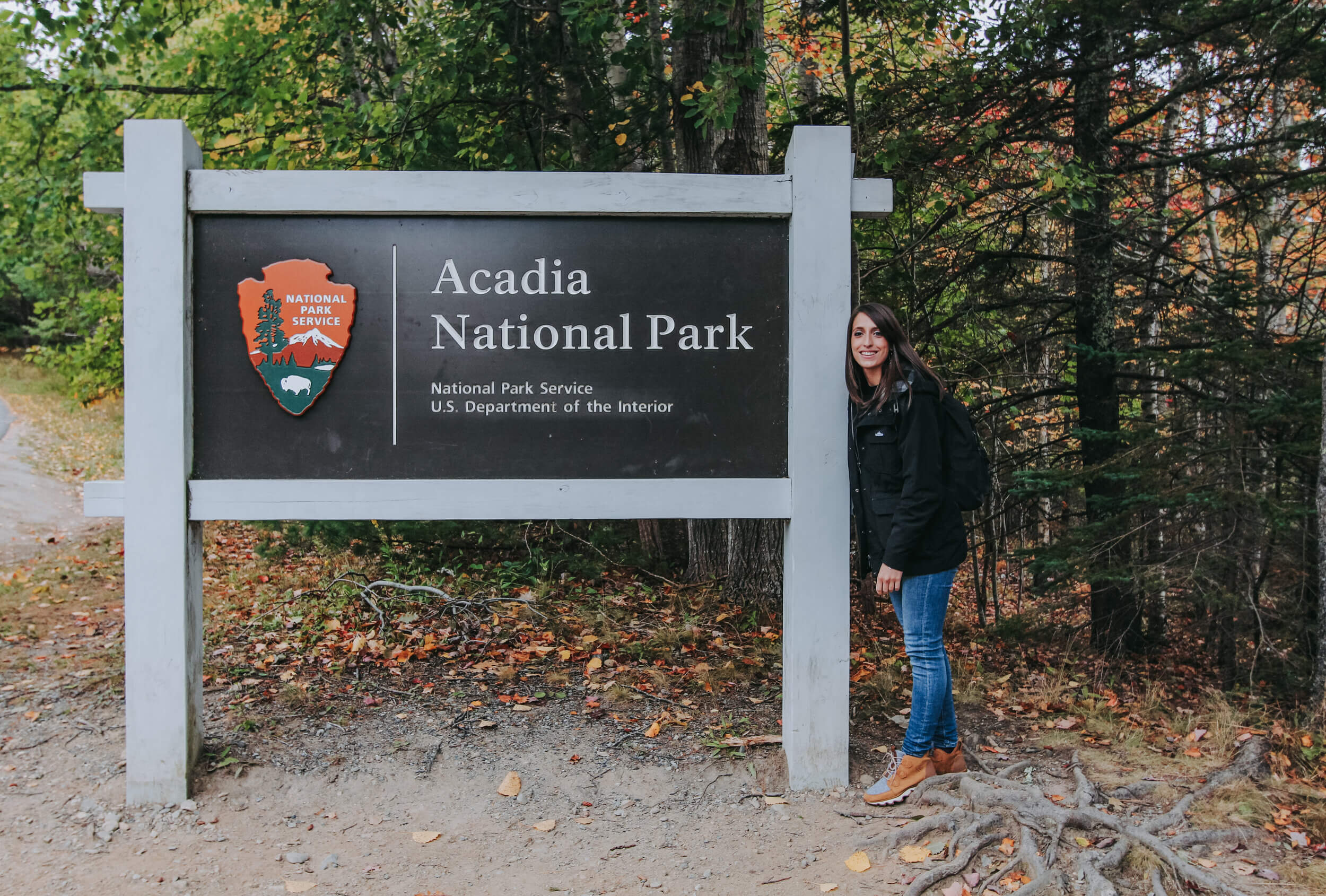
It has become a tradition that every year my dad and I travel to a different National Park in the United States, and this year was to Acadia National Park! We have traveled to many parks over the years, but this is the first time we ventured to one on the Eastern side of the country. Acadia National Park is the most Eastern Park in the United States and is located along the coast of Maine in New England. Acadia has been on my list to visit for years, and we spent 3 full days exploring the park and the nearby seaside town of Bar Harbor. To read more about our road trip through Maine, on the way to Acadia National Park, check out the post here.
During our 5-day stay in Maine, we lodged in Bangor, Maine, which is about an hour away from Acadia National Park and the Bar Harbor area. We drove to the National Park every day, leaving at about 7:30 am and arriving at 8:30 am, promptly for the Visitor Center to open. Staying in Bangor was a bit more economical than staying in Bar Harbor, especially when we traveled in the peak season of October. By driving to and from the park, it was a great way to explore the surrounding towns of Maine, while stopping at shops and markets along the way.
We split our 3-day stay in Acadia National Park into 3 different itineraries. We encountered some inclement weather on day one, so after exploring Park Loop Road, we ended the day, like every day at at Acadia National Park, with some time exploring the neighboring town of Bar Harbor. To read more about the different stops and sights, continue reading!
Day 1: Park Loop Road (Sand Beach, Thunder Hole, Otter Point)
Day 2: Cadillac Mountain + Jordan Pond
Day 3: Precipice Trail + Beehive Trail + Park Loop Road
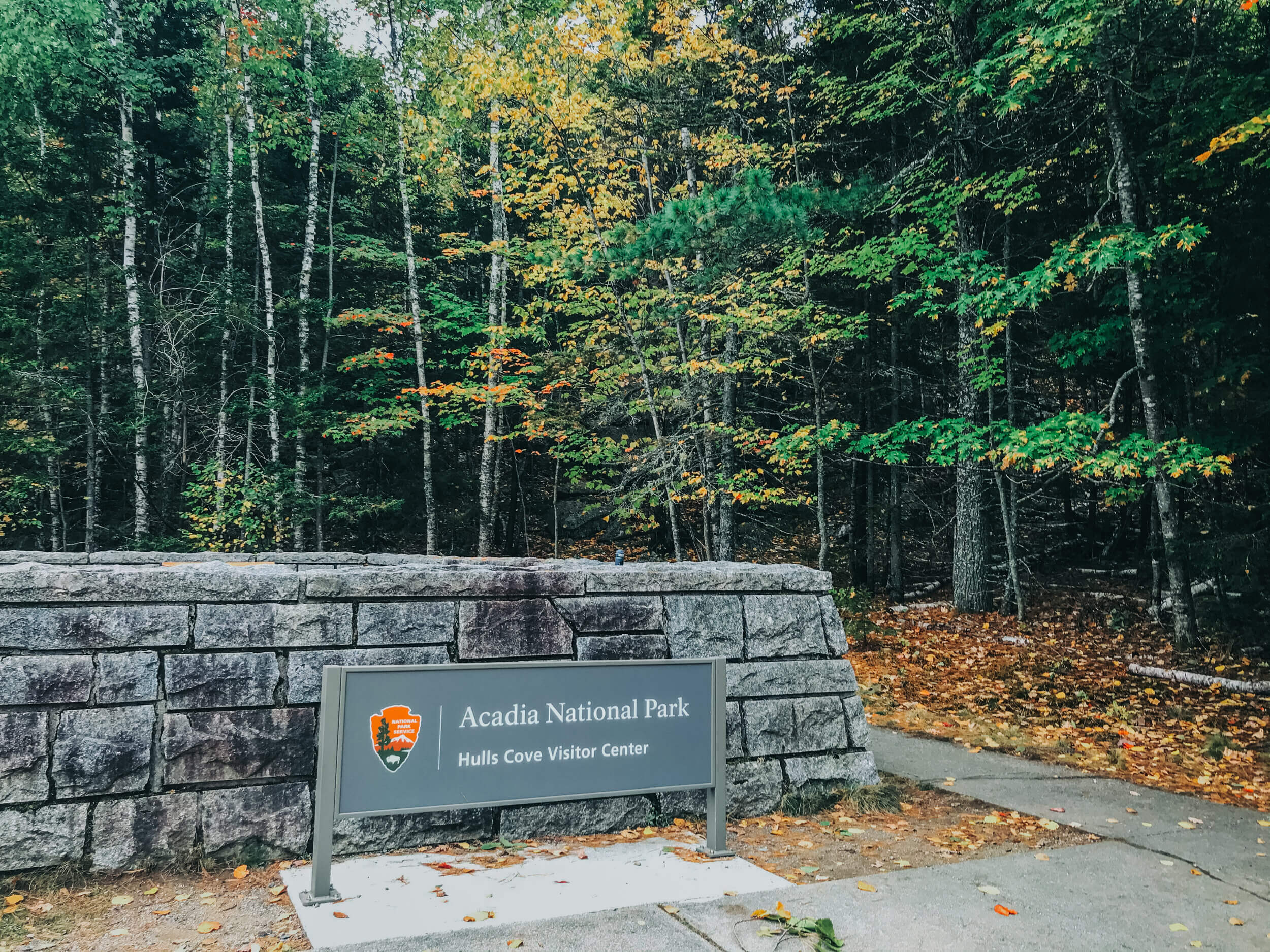
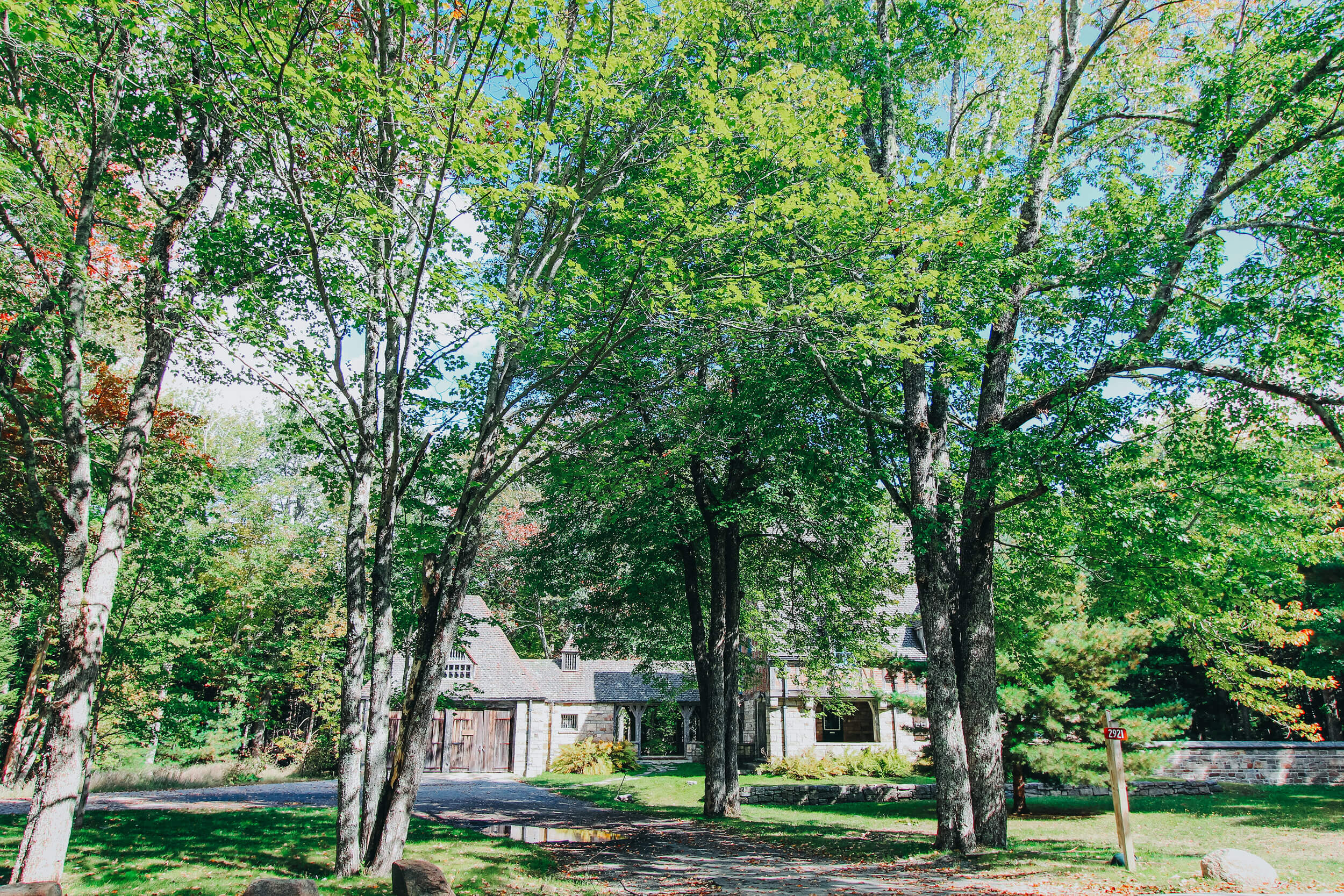
HULLS COVE VISITOR CENTER
Each morning while in Acadia National Park, we began the day with a stop at the Hills Cove Visitor Center, just within the grounds of the National Park. After an hour’s drive from Bangor, we would get out of the car to stretch our legs, eat a snack, and use the restrooms at the Visitor Center. Depending on what you are planning for the day, this may be the last time you are near indoor restrooms- so I would make the stop. There is also a gift shop and an area where you can speak to park workers about the different areas of the park. Although I do extensive research before I visit a National Park on the sights to see and trails to hike, I always make the time to talk with someone at the visitor center on my first day in the park. Most of the time, they affirm the list I have made, but I always find more information about a few hidden gems in the park!


PARK LOOP ROAD
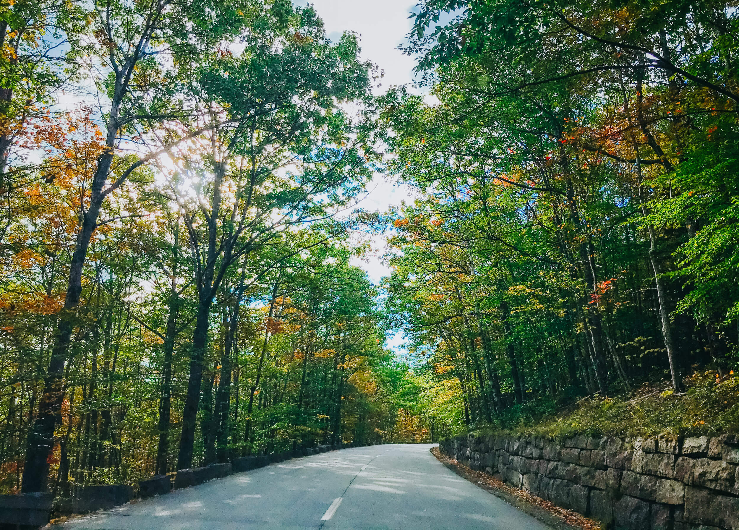
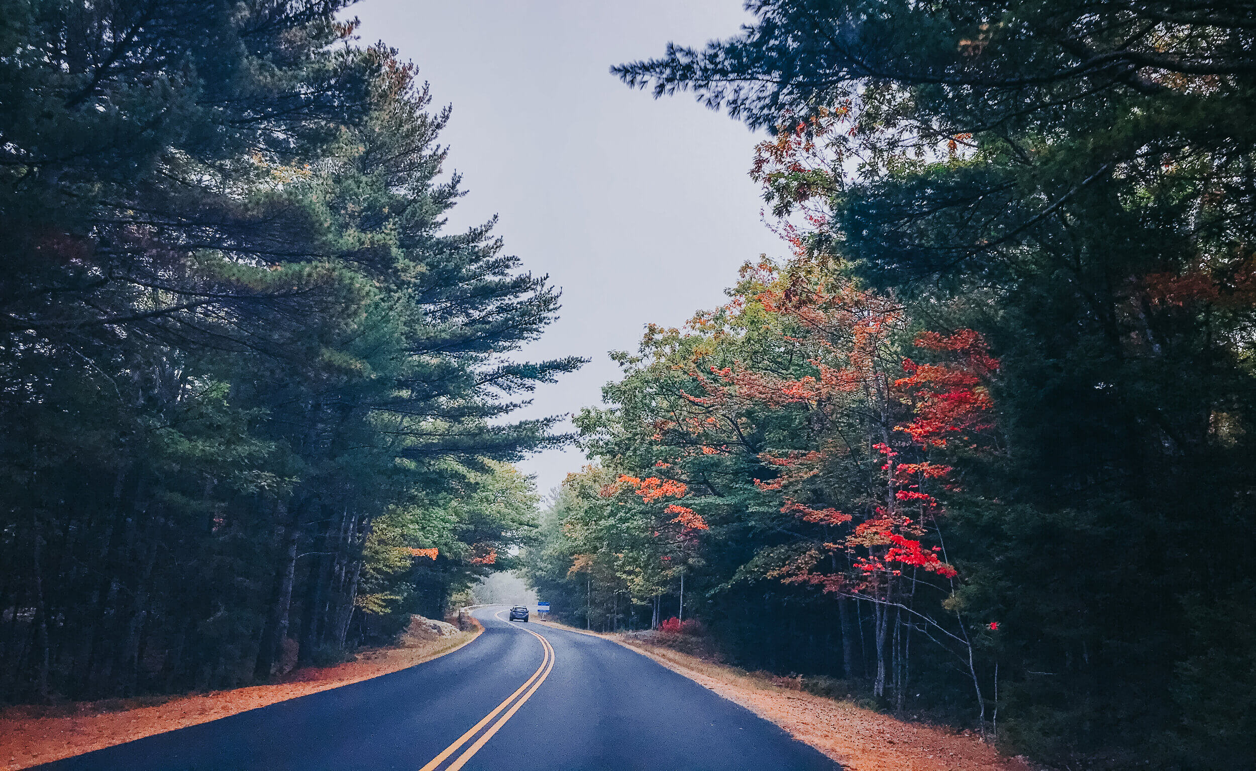
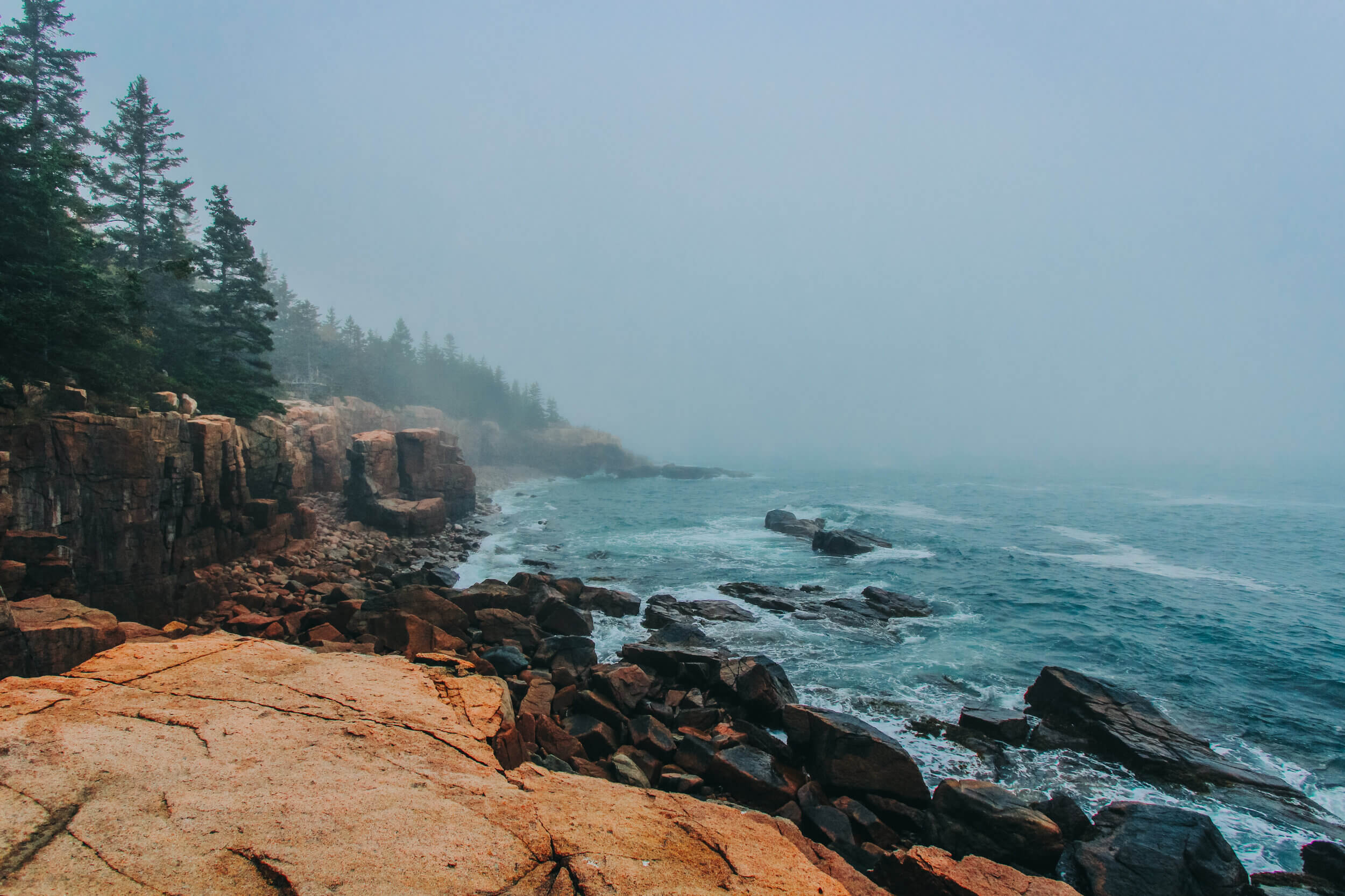
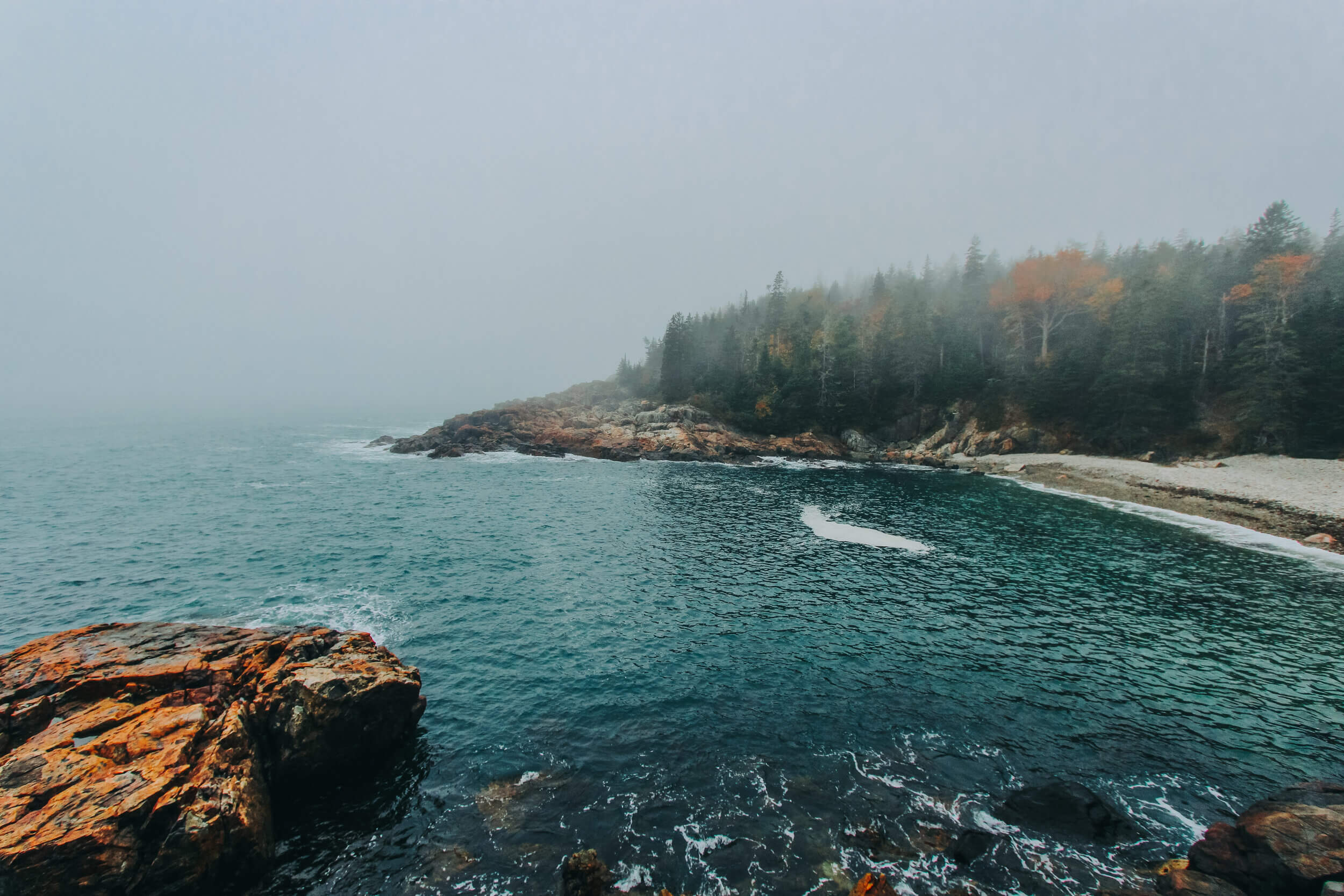
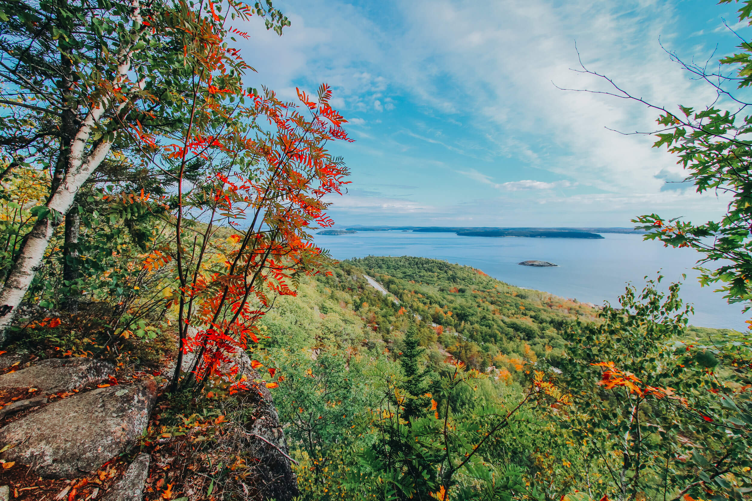
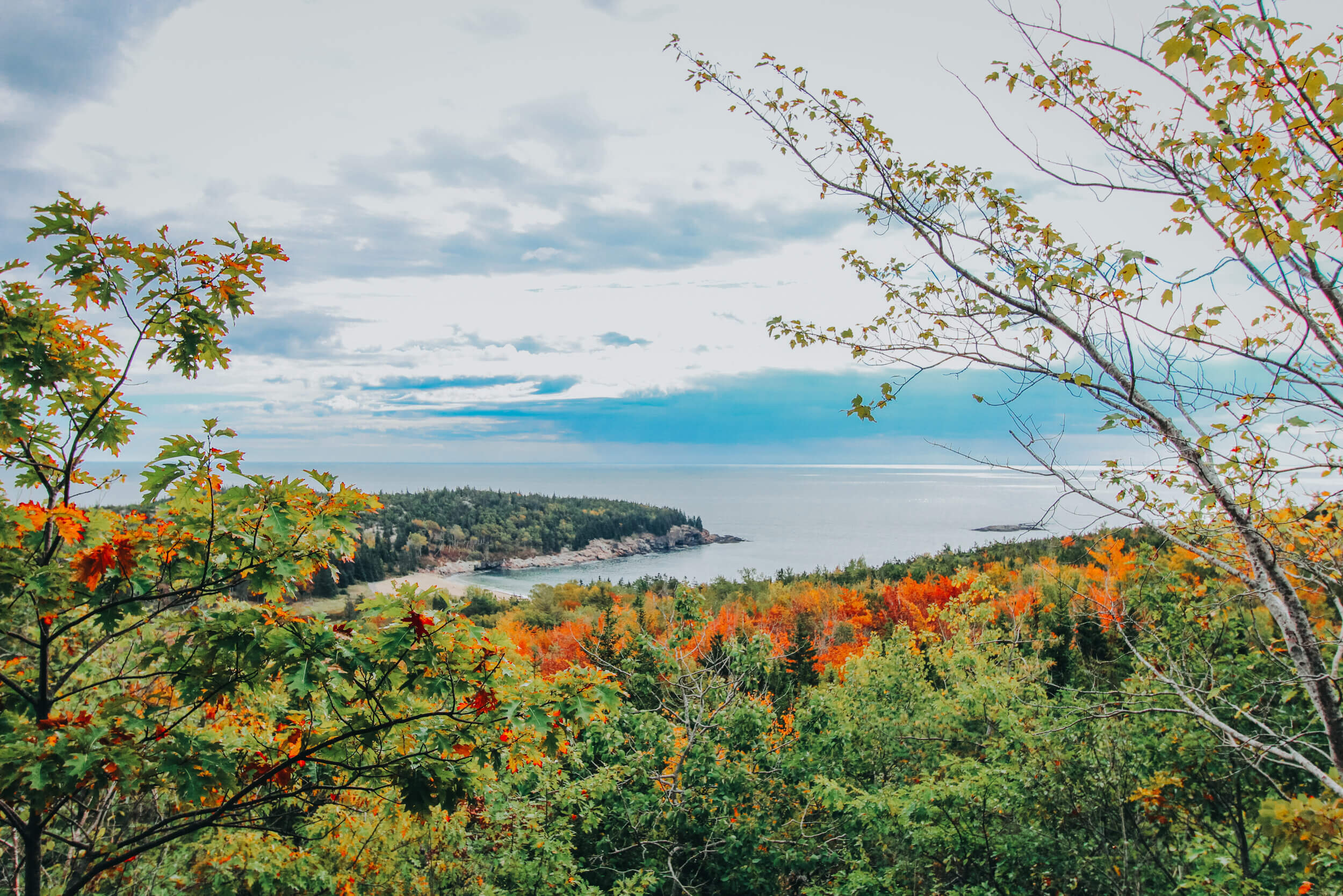
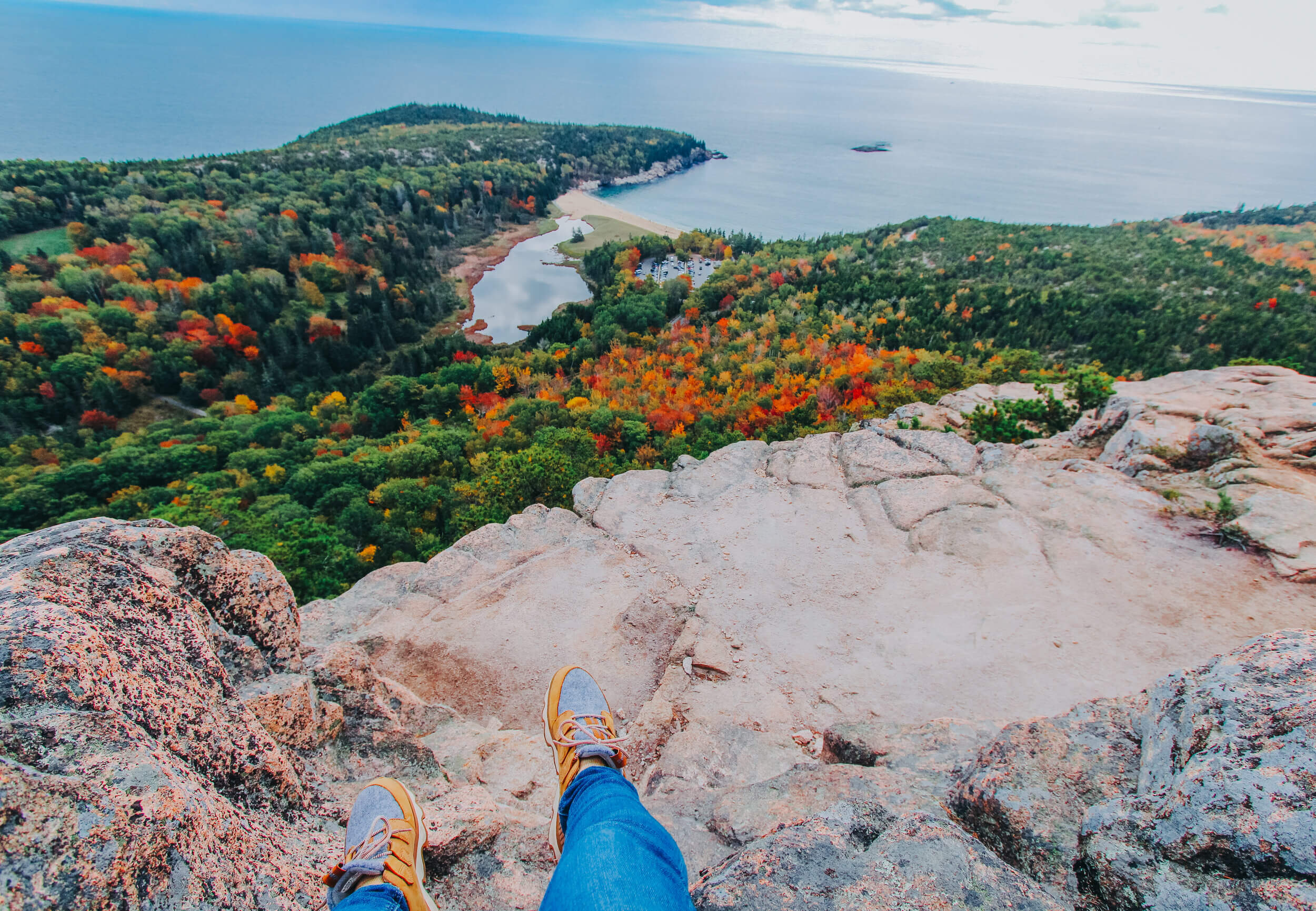
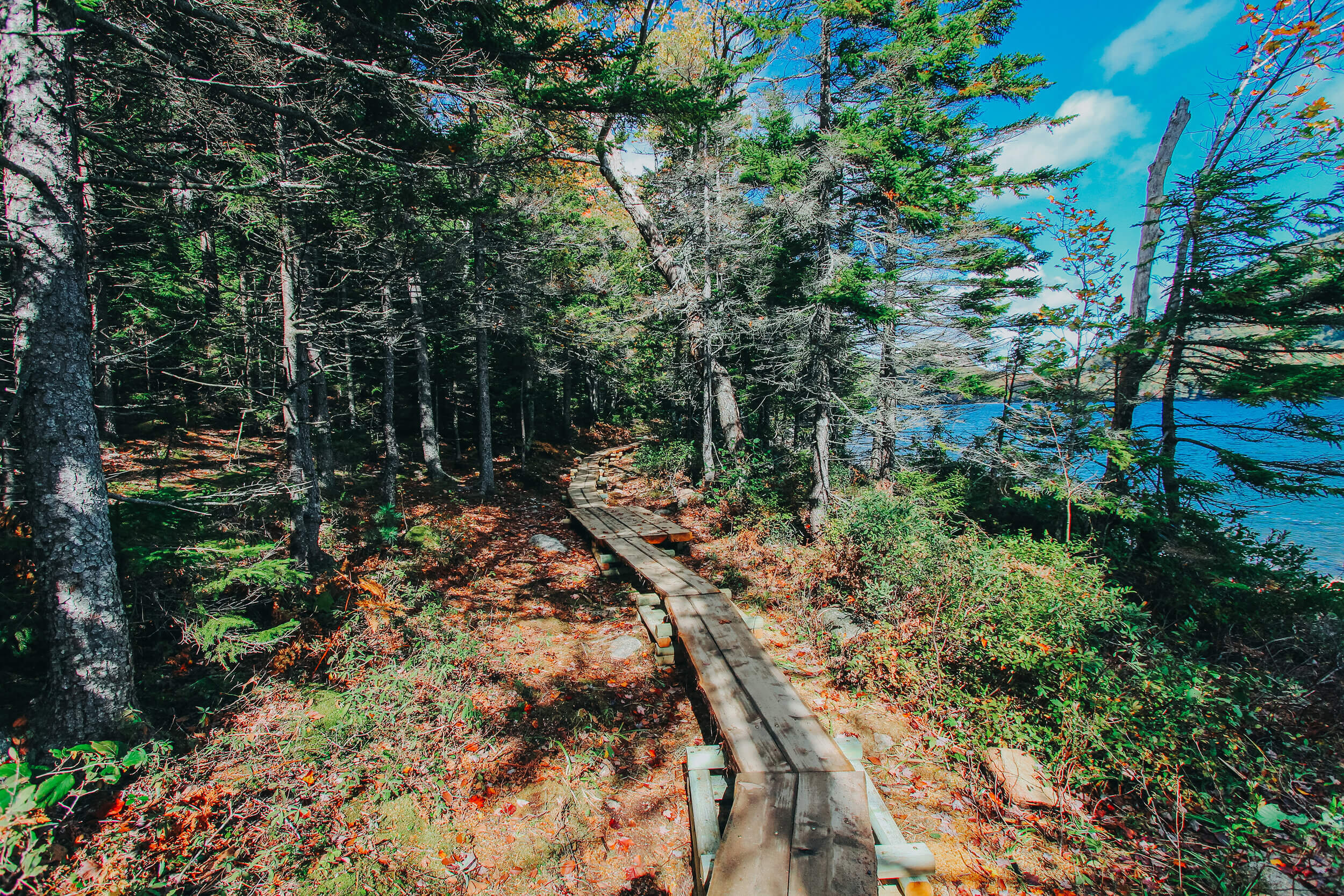
This is one area of the park that is a “must-see!” The 27-mile road begins just outside of the Hulls Cove Visitor Center and encircles the National Park. Around the area of the Sand Beach Entrance to the park, the road becomes one-way and the National Park fee is required to enter. Along the coast, there are several pullover points where you can stop and take in the views of the Maine forests and coastline. There are several sights to see as you drive through the park on this road including Sand Beach (very close to the Beehive Trailhead…more on that later!), Thunder Hole, and Otter Point.
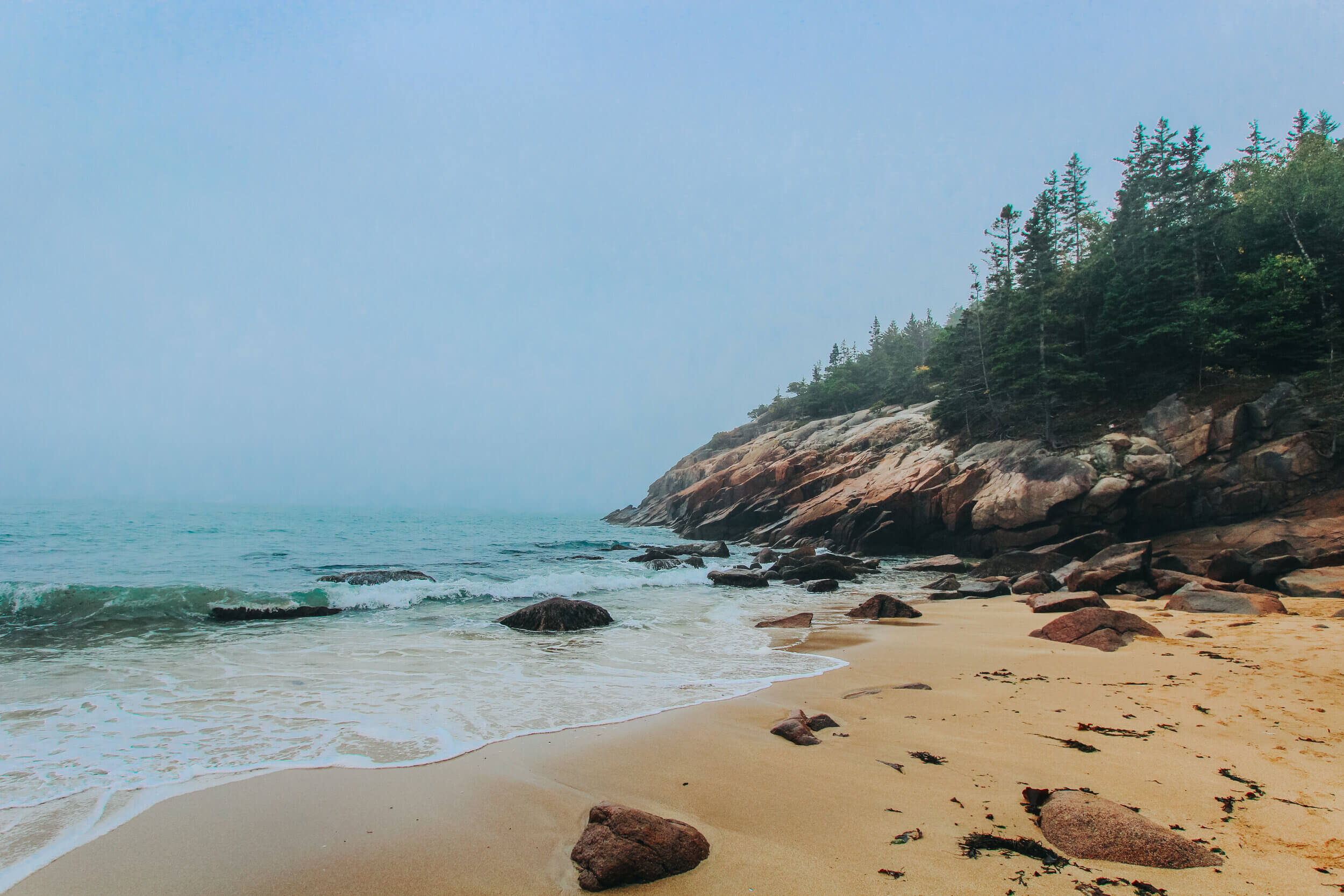
SAND BEACH
Nestled between the granite mountains and the rocky coast of Mount Desert Island is Sand Beach The 290-yard beach is one of the most popular areas of interest among visitors to Acadia National Park. Access to Sand Beach can be found just after the park entrance, and parking can be a bit tricky, especially during peak seasons of the year. I suggest parking in the first spot that you see and walking a short distance to the beach if possible. Since the road is one-way, there is no going back to a spot that you passed.
Along the road, there is an oceanside trail following the shore’s edge that is parallel to Park Loop Road. If you are planning on spending the entire day exploring the sights along Loop Park Road, this is worth the trek. This path will take you to sights such as Thunder Hole and Otter Point to the south and you can view all of the stunning sights of the coastline in between!


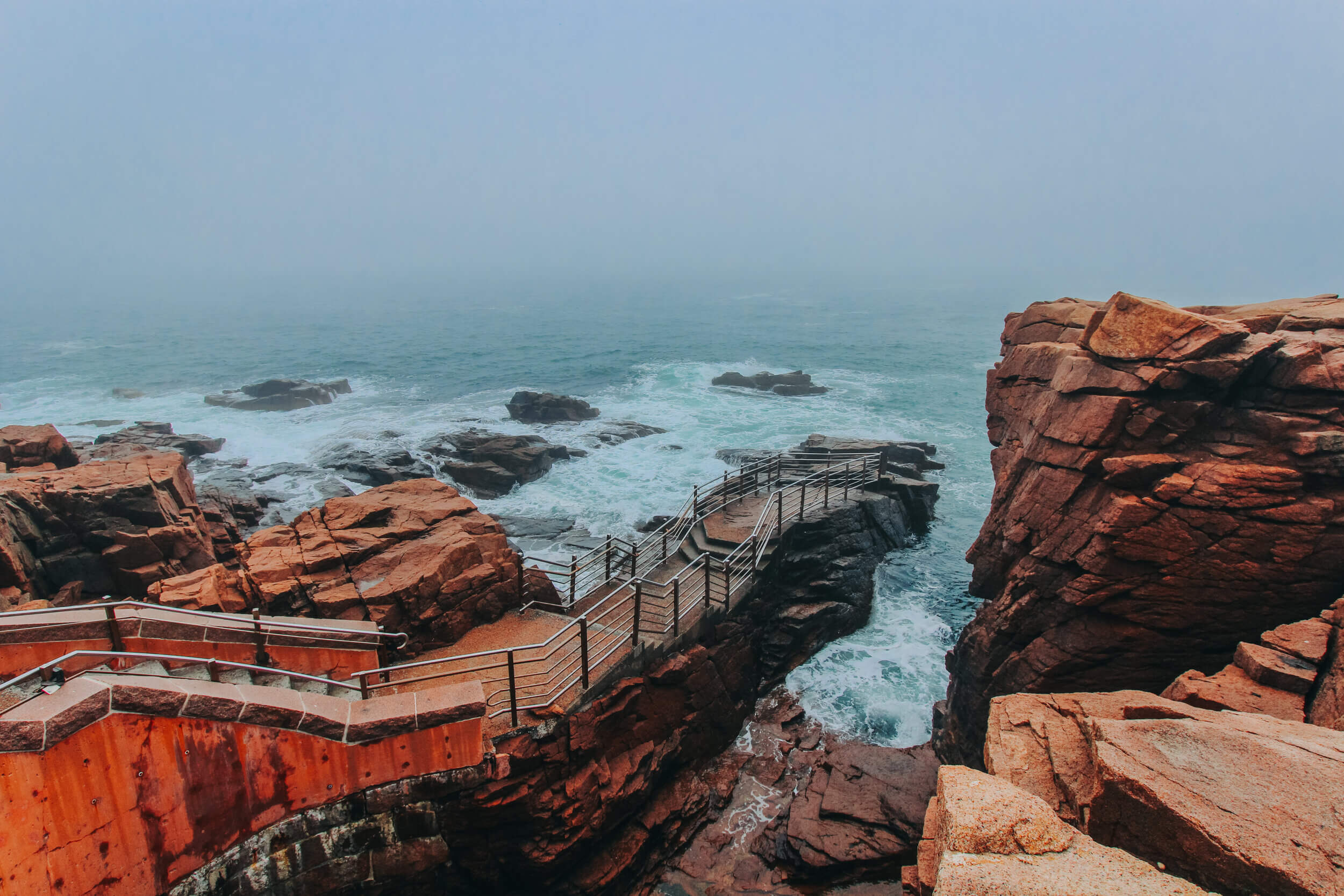
THUNDER HOLE
The next stop past Sand Beach on Park Loop Road is Thunder Hole. You will see spectators standing around the naturally formed inlet, not only to take pictures and take in the beautiful sights of the coast but to wait for the right wave to pass by. When this happens, a deep, thunderous sound emerges from the water. There is a small cavern that is formed, just beneath the surface of the water. When air enters this cavern and it collides with the force of the water, it creates a sound like thunder, hence the name “Thunder” Hole. When this happens, water can splash into the air as high as 40 feet!
This spot offers some of the most striking features of Acadia National Park. On the south side of Thunder Hole, you can explore the rocky coastline. I spent a good while here, parked on the cliffside, just watching the waves roll in. (Side note, my zodiac sign is a water sign, so I was definitely in my element in this setting!)
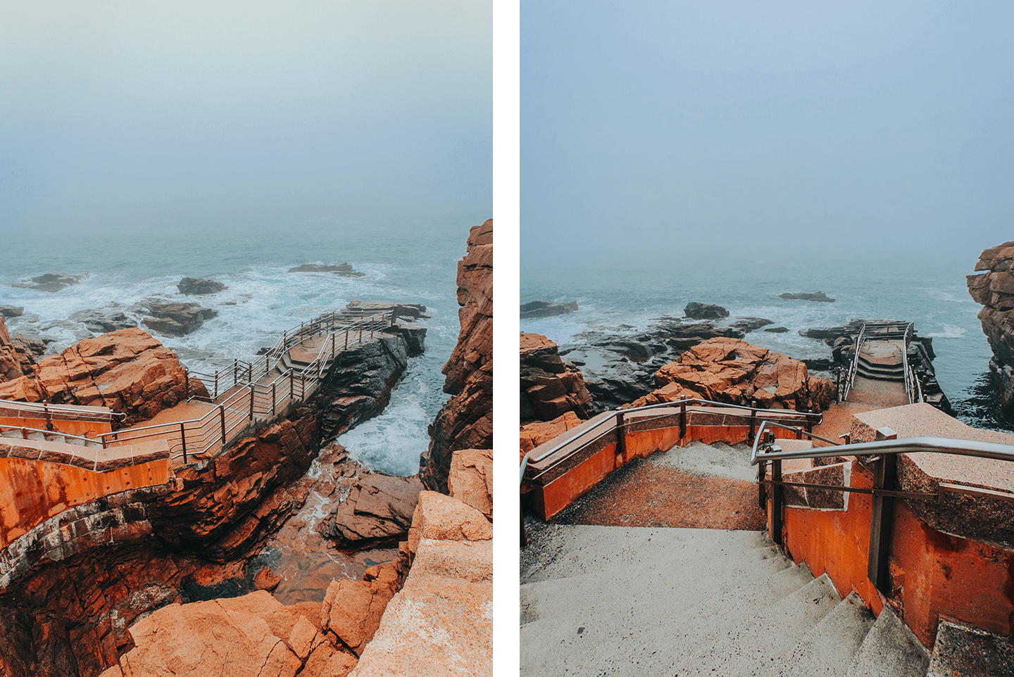


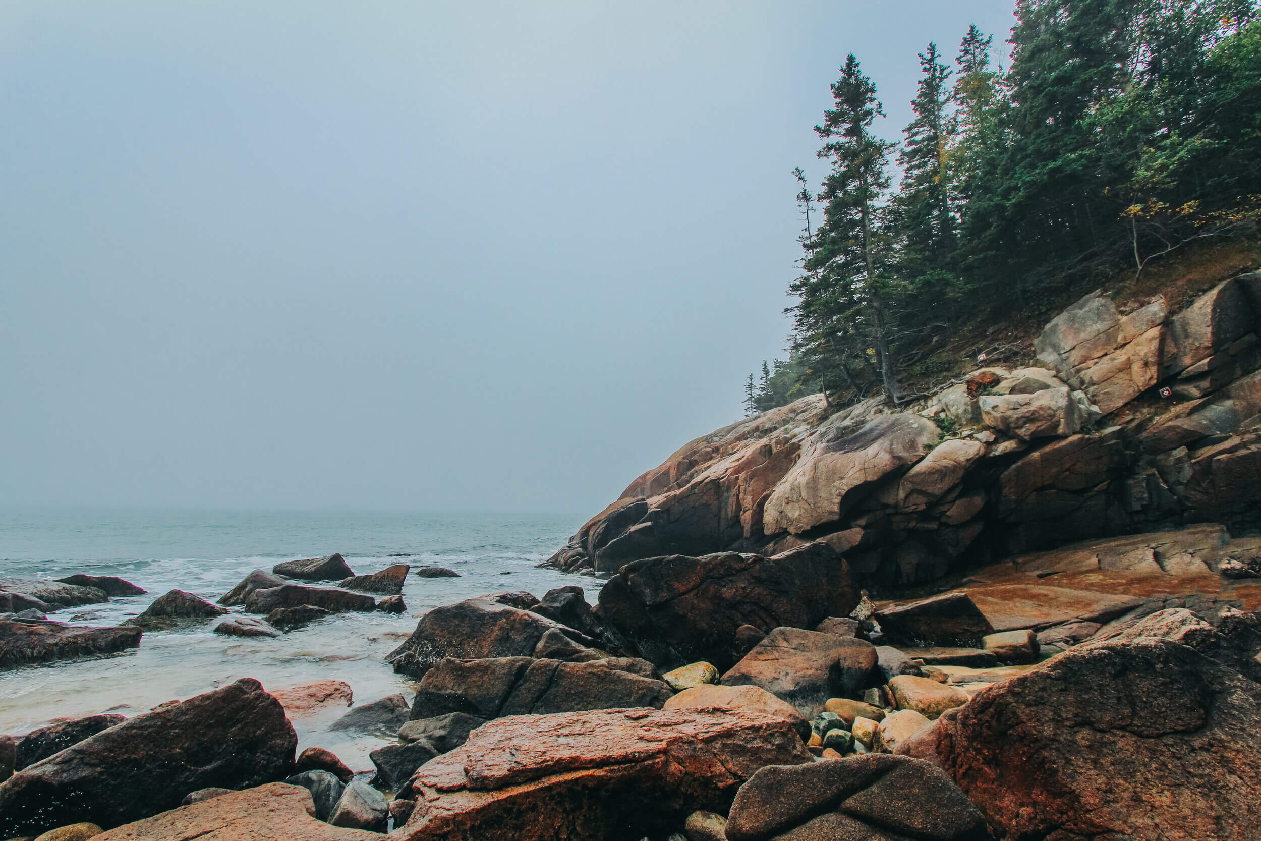
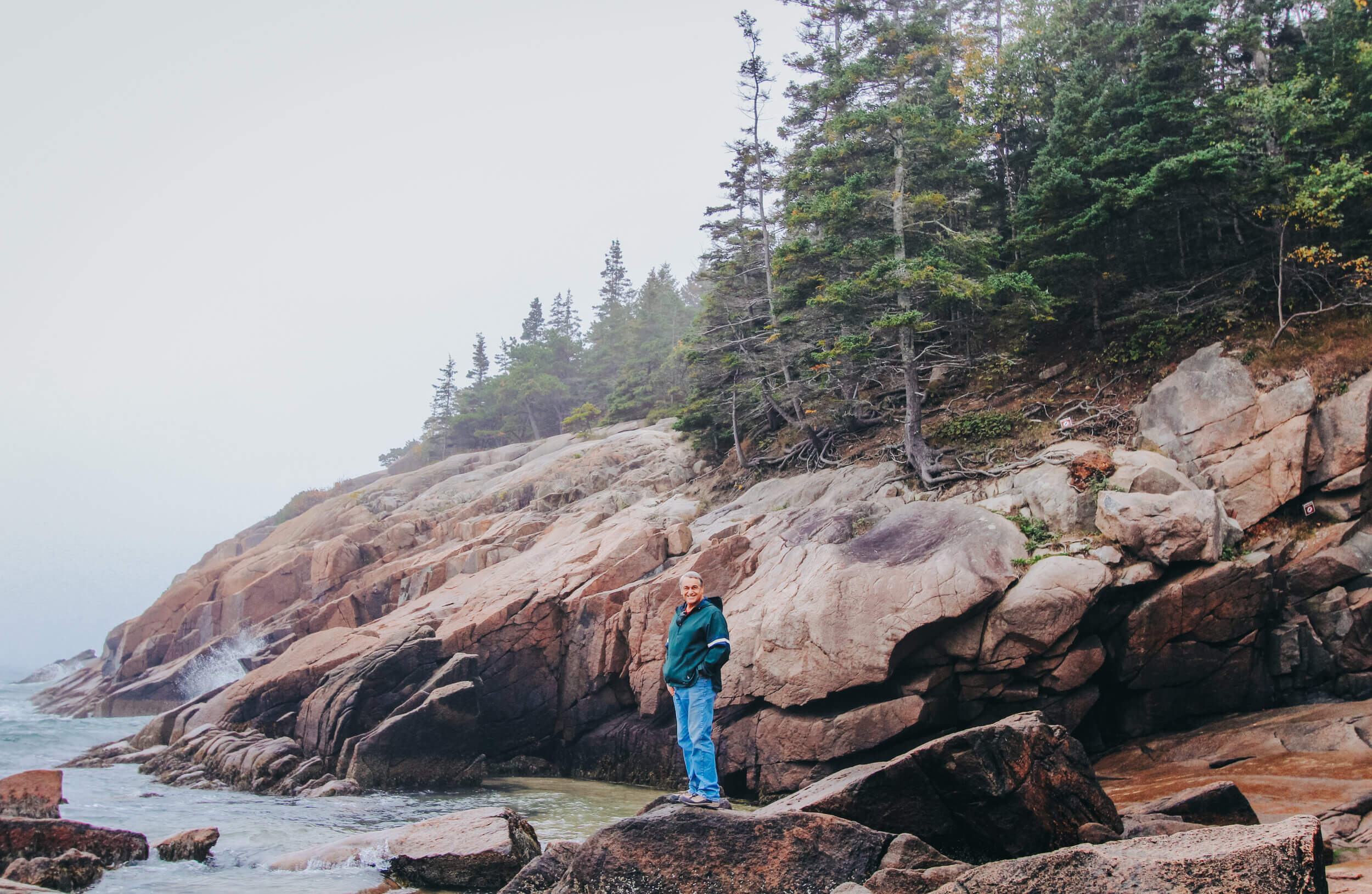
OTTER POINT
This was by far my favorite stop along the one-way area of Park Loop Road! Located roughly 0.7 miles south of Thunder Hole, Otter Point and Otter Cliff are the next stops along Park Loop Road. By the time we drove to this spot the crowds had dispersed, and we felt as though we were the only ones exploring the area. The cliffs of Otter Point are 100 feet high and are one of the highest headlands north of Rio de Janeiro in Brazil. This provides several areas along the coastline for stunning views!


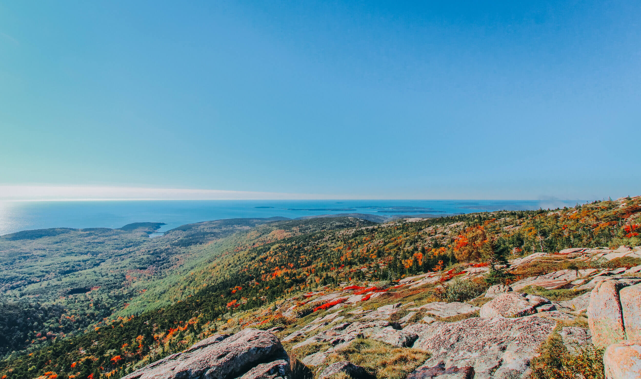
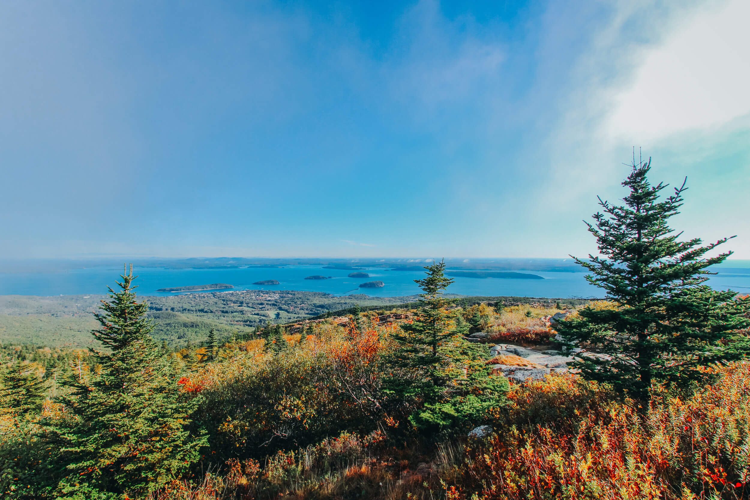
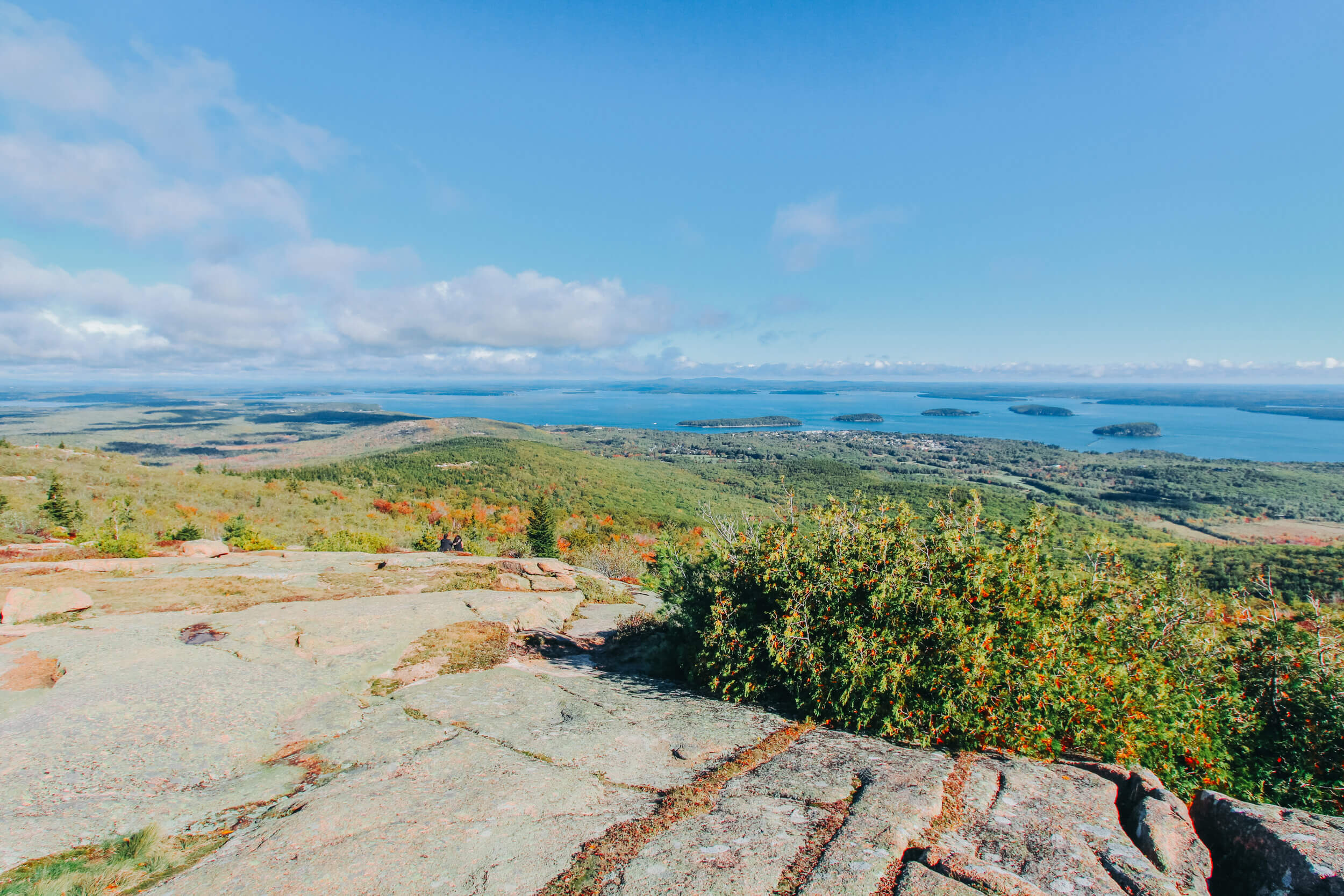
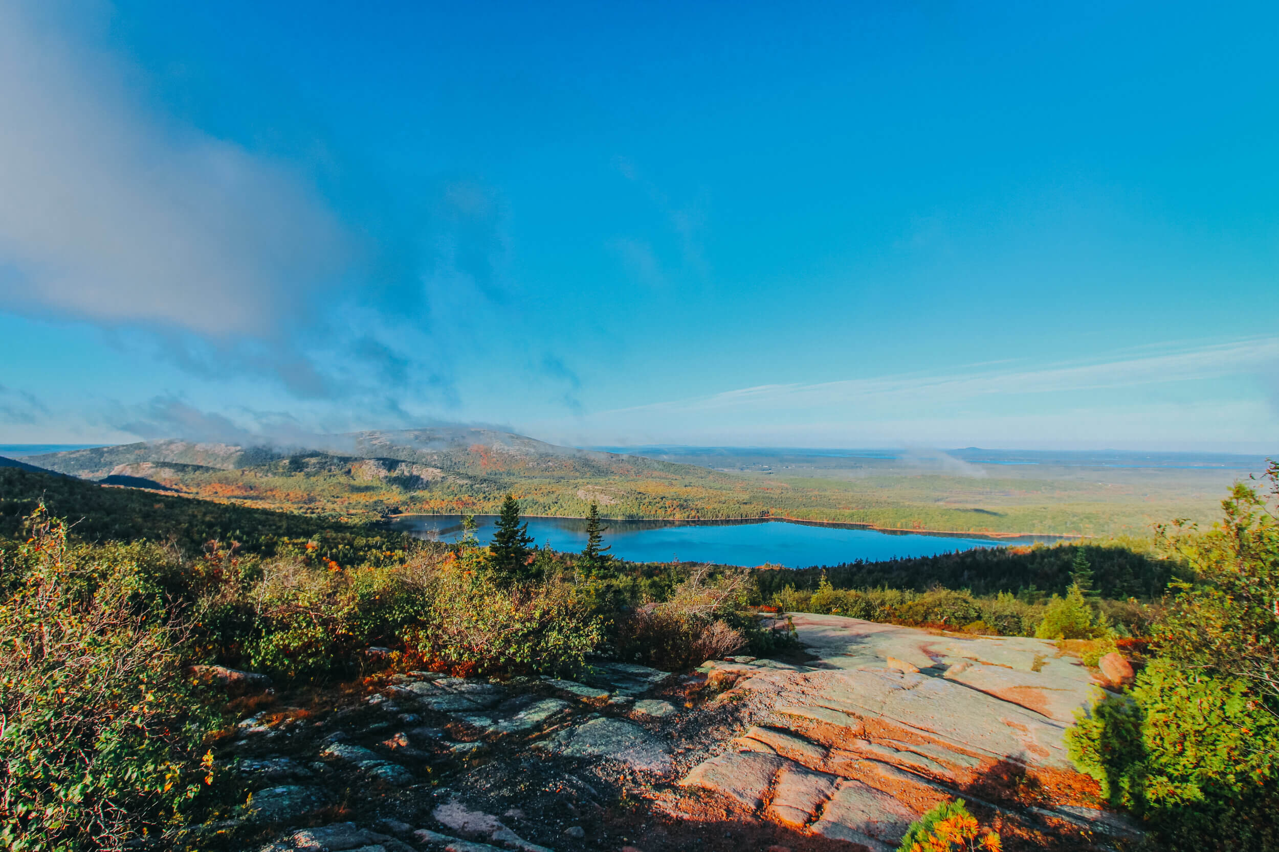
CADILLAC MOUNTAIN
Cadillac Mountain is the tallest mountain on Mount Desert Island (at 1,530 feet!) and is the highest point along the North Atlantic seaboard. At certain times of the year during the fall and winter seasons, it is the first place to view the sunrise in the United States! It is a definite must-see to view the sunrise here. The auto-road to the summit opens at around 4:30 am to allow cars to drive to the top in preparation and anticipation for the sun’s rising. If visiting the park during the summer season, keep in mind that you will need a valid vehicle registration and reservation, specifically for the Cadillac Mountain Summit Road during sunrise and daylight hours. We did not know about this reservation system until arriving at the park on our first day, and by that time, all reservations for the sunrise for the days we would be at the park were sold out. Plan ahead! Luckily, we were able to make a reservation for 8:30 am on our second day in the park to still enjoy the beautiful sights of the mountain in the early am hours. By that time, those from the sunrise rush had already left, which made finding a parking spot at the summit a lot easier!
At the summit of Cadillac Mountain, there is a trail, roughly 0.4 miles, that will take you around the top of the mountain to see the different views of Maine and the coast. On the northwestern side, you can spot Eagle Lake and Western Bay. To the south, you can see the Cranberry Islands. The northeast will give you views of Bar Harbor, the Porcupine Islands, and in the distance, the Schoodic Peninsula.


ACADIA NATIONAL PARK TRAILS
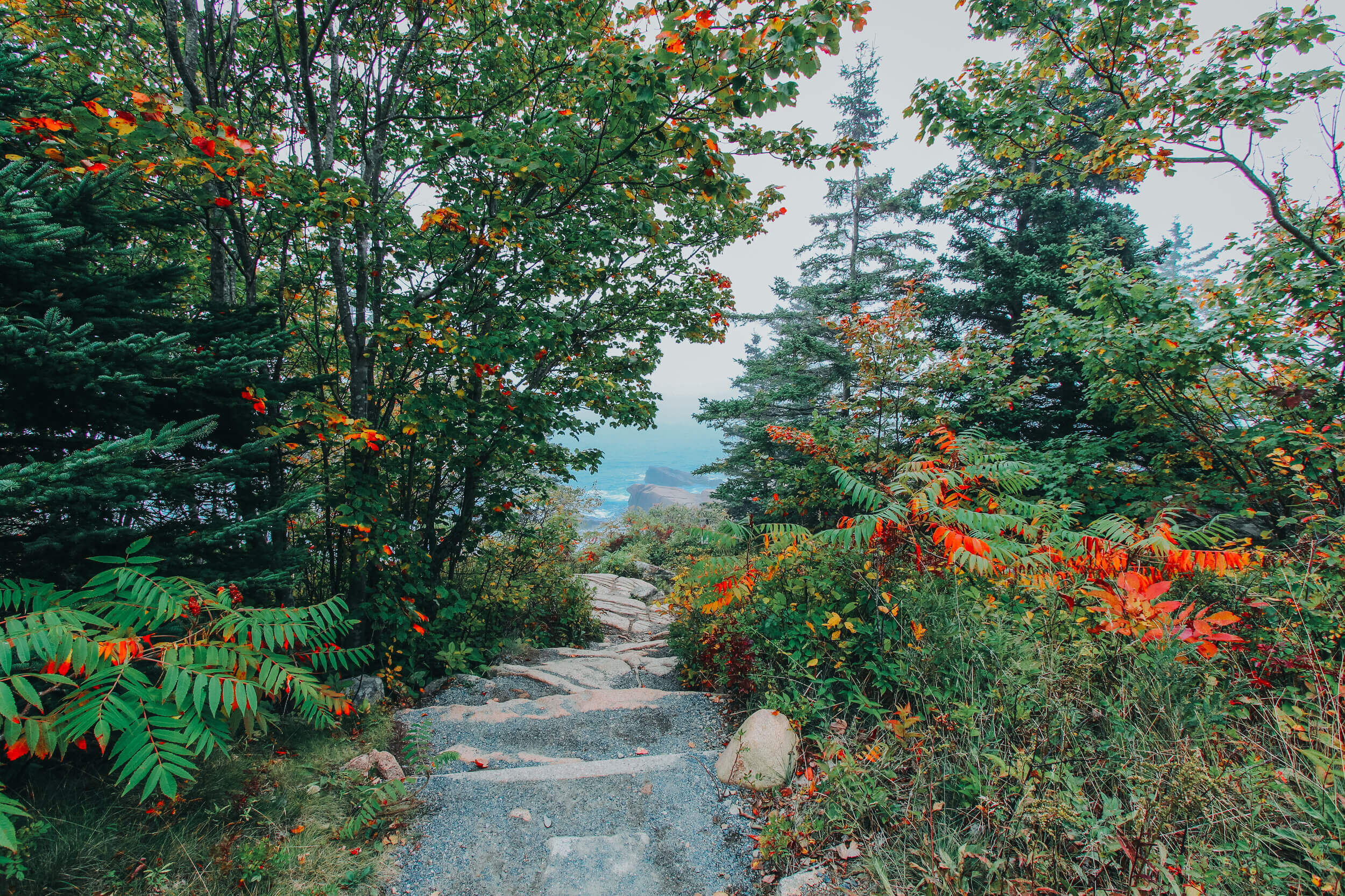
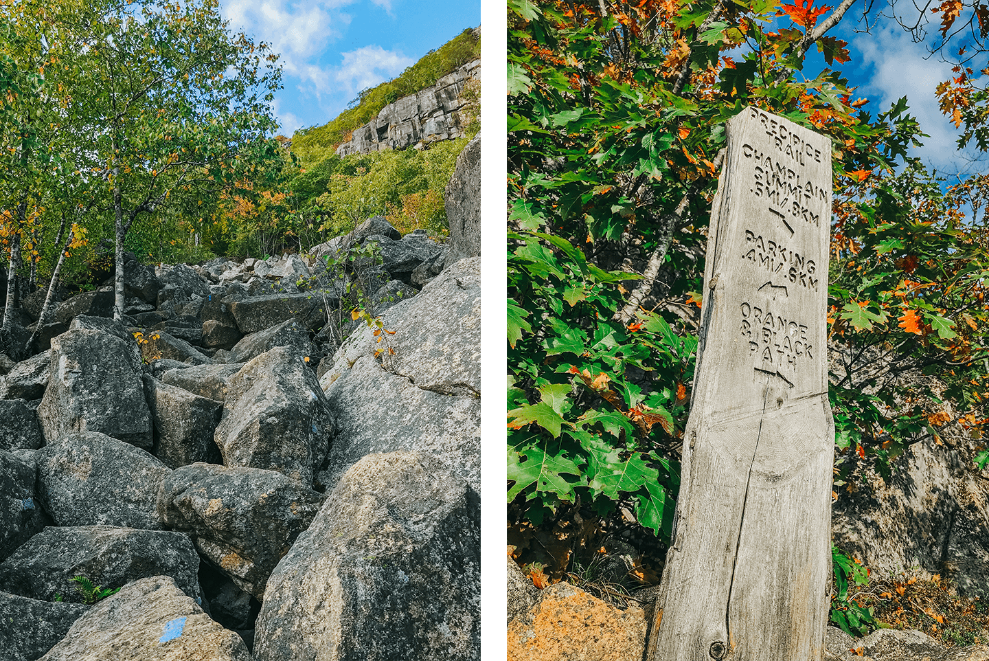
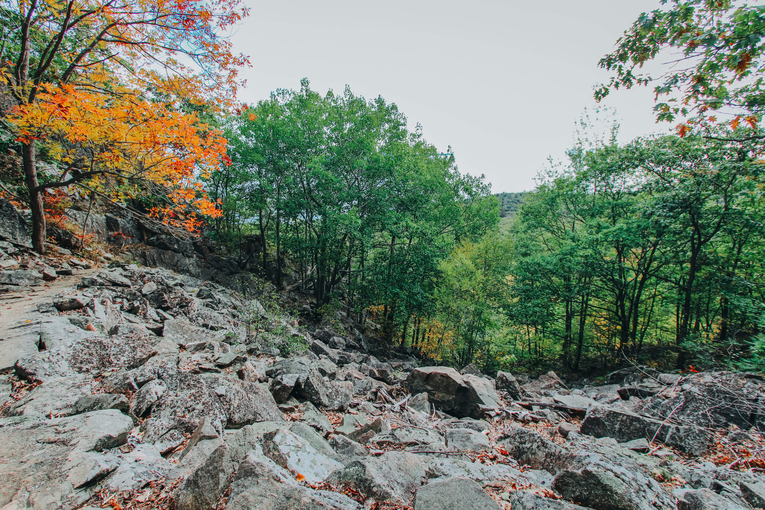
PRECIPICE, ORANGE AND BLACK LOOP TRAIL
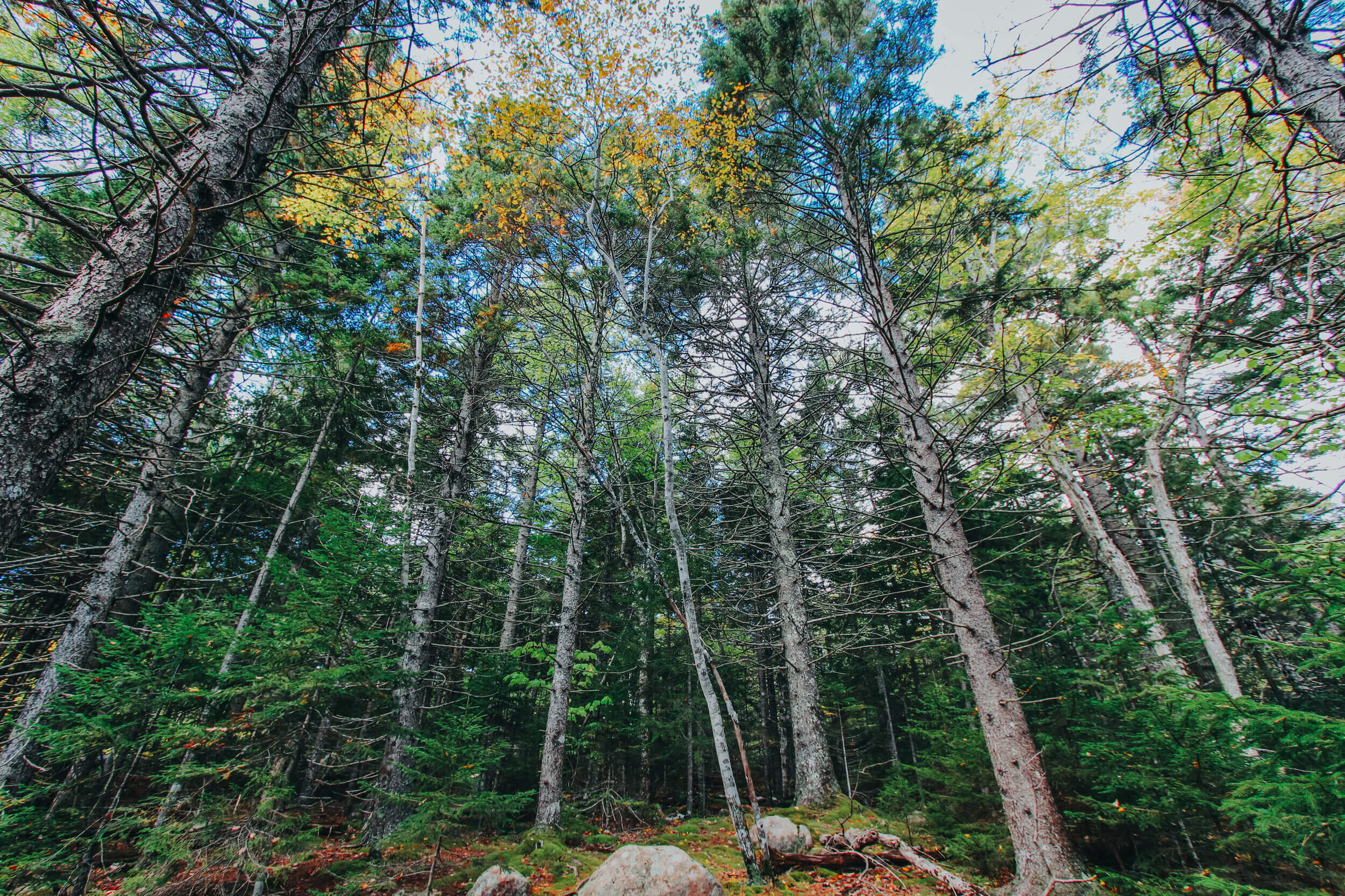
This is by far the hardest hike that I experienced while in Acadia National Park. I do not recommend this hike to beginners. The beginning of the trail comprised of scrambling up large boulders and progressed to gaining elevation up the rocky mountainside with iron rungs and scaling the cliffside. The Precipice Trial can veer off into different trails, like the Champlain North Ridge Trail at the summit of the mountain. We hiked the Precipice, Orange and Black Loop since this was our first hike of the day, and wanted to save some energy for the Beehive Trail and other sights throughout the day. A roughly 2.1-mile loop will take you 1,053 feet in elevation to some beautiful sights! The Precipice Trail is labeled with blue markers, as is the Orange and Black trails.


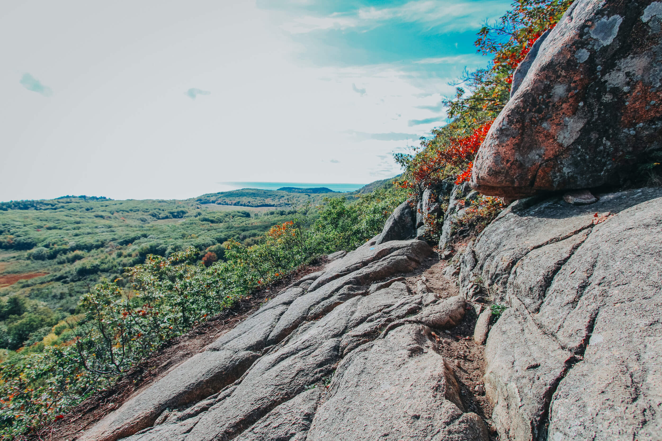
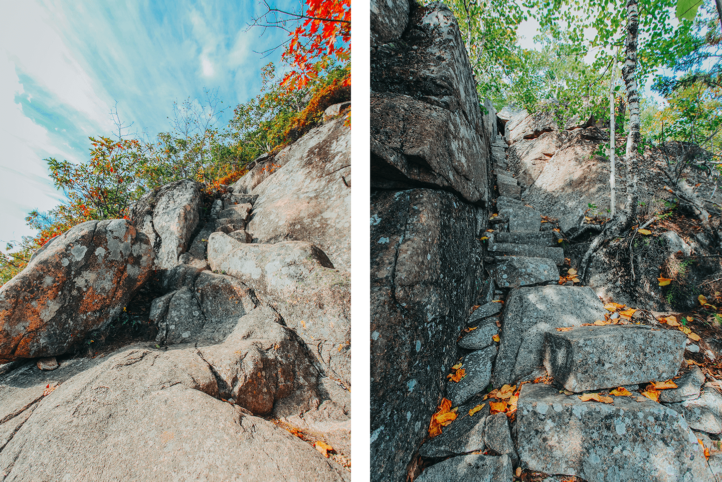
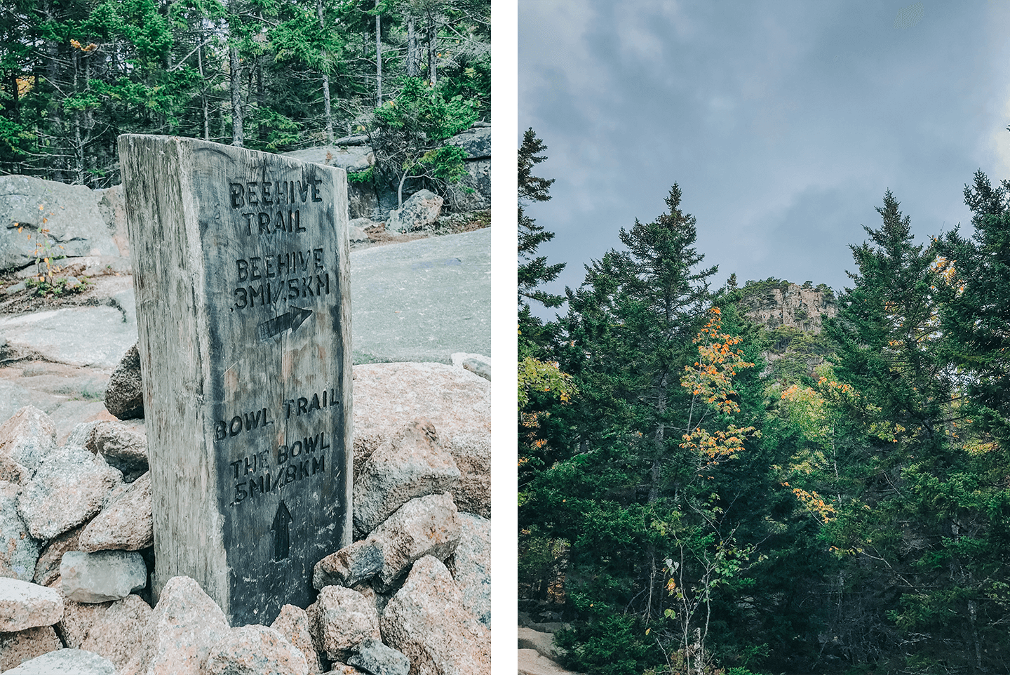
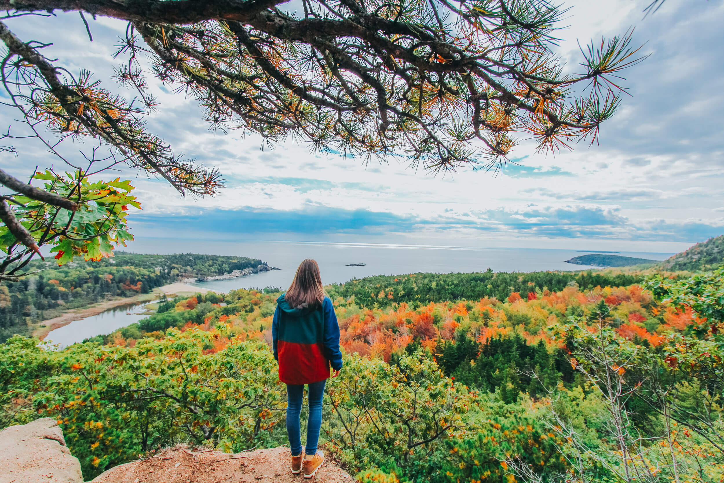
BEEHIVE TRAIL LOOP TRAIL
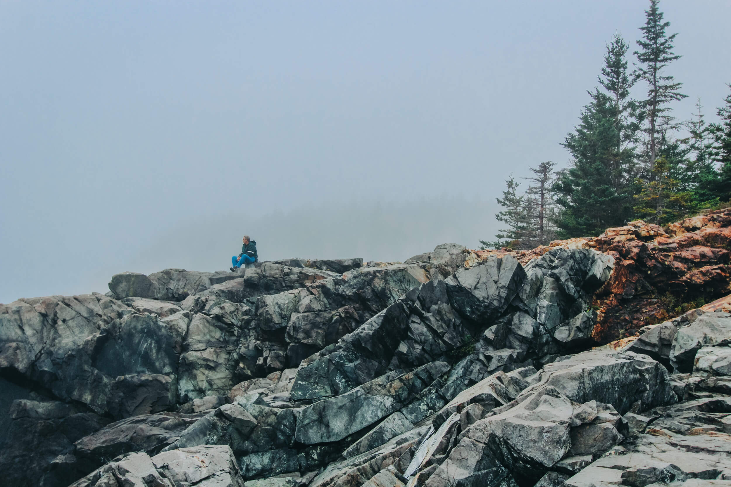
The Beehive Loop Trail is one of the most popular trails in the park, and the entire loop is 1.4 miles. If you are an adventure seeker who is looking for a great view of Sand Beach, the Atlantic Ocean, and the beautiful Maine coastline, this trail is a must. If you are at all scared of heights, I do not recommend this hike. The majority of the hike to the summit is a vertical climb on metal rungs that are installed into the mountainside, and some areas are cliffside with metal rungs and no barrier between you and the ground below.
On AllTrails.com, the hike is label as “hard,” but I found it to be a breeze compared to the Precipice Trail. The elevation gain is steep, but easier if you go slowly up to the peak, and the view is worth it! If you would like to still hike to the peak of the mountain, but would rather not experience the steep elevation from the climb up the mountain on cliffside metal rungs, you can always hike up the back part of the trail, making the hike an out-and-back trail. I met a lot of people on the trail who had dogs with them, and this was a great adaption to the trail for them! Once descending from the peak, the loop trail links up to the Bowl Trail, which you can choose to hike around or continue back to the Beehive.
Just beyond the Sand Beach entrance to the National Park, you will find the Beehive Trailhead wedged in an unassuming spot in the woods. Parking can be found along the side of the road by Sand Beach Parking. Since Park Loop Road is one-way, the right lane is open to parking. I suggest parking in the first spot you can find because parking is limited! Since this trailhead is located off of Park Loop Road, park admission is required beyond the Sand Beach Park entrance. Another option is to park before the park entrance at the Precipice Trail and walk along the road to the Beehive Trail. This way, you only have to park once for both trails, and you do not have to drive through the entirety of the one-way Park Loop Road after your hike.

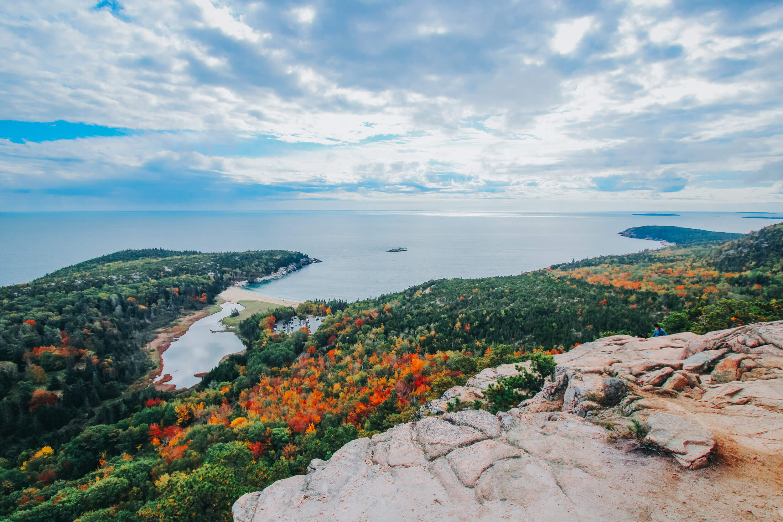


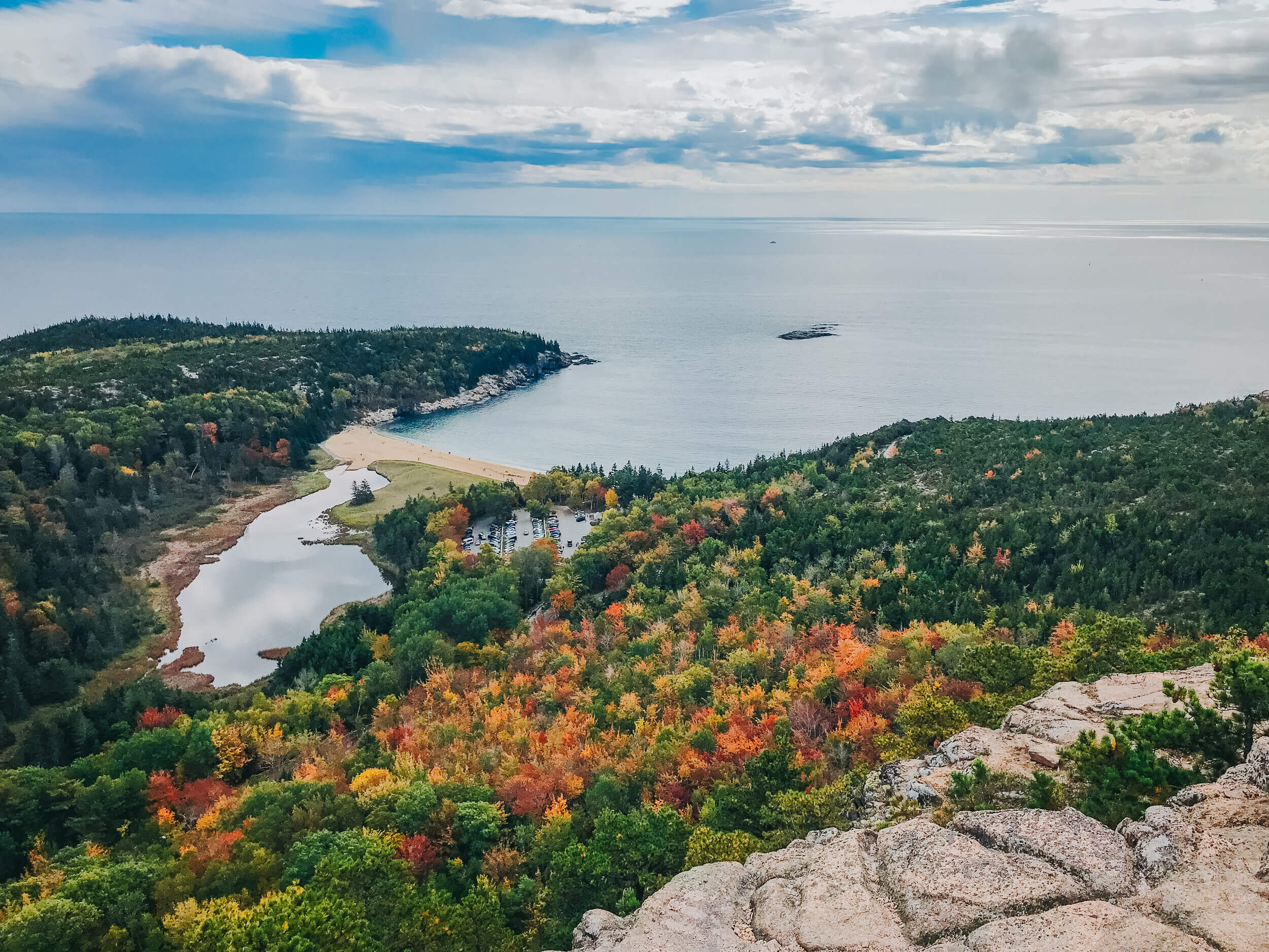
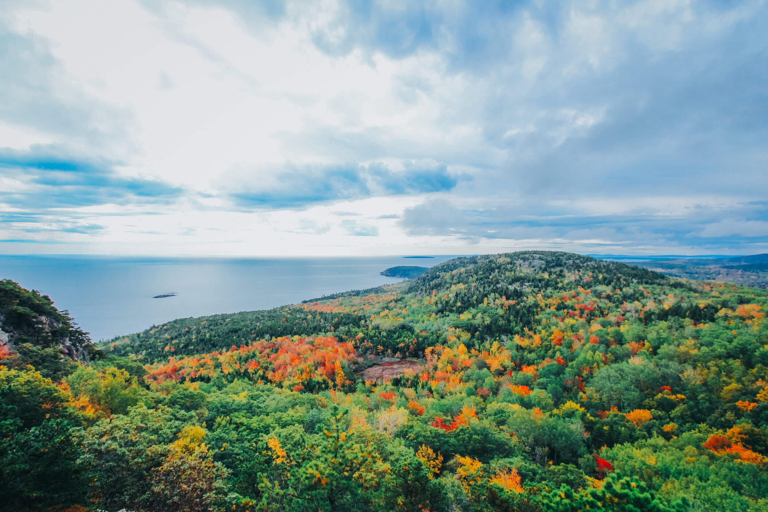


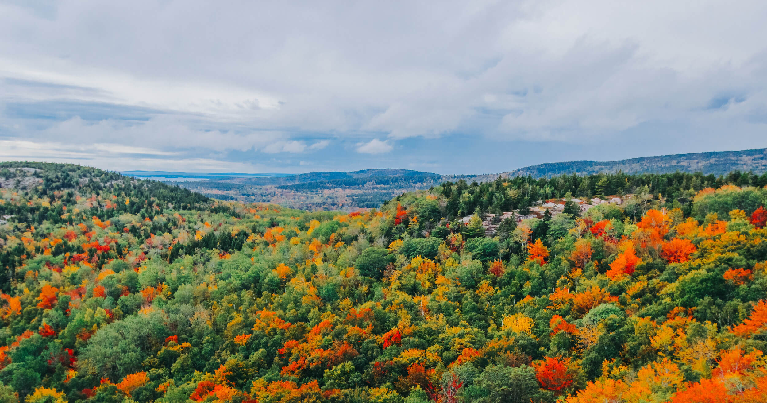

The views of the park during the first weekend of October were spectacular! I highly suggest a visit to the park during this time of the year.

The view from the Bowl trail. The Beehive Trail connects to the Bowl Trail at this point. You can choose to walk around the lake or return to the trail at the end of the Beehive Loop. Some hikers opt out of the Beehive completely and just hike straight to the Bowl. It is very peaceful and relaxing- perfect for a break during your hikes!

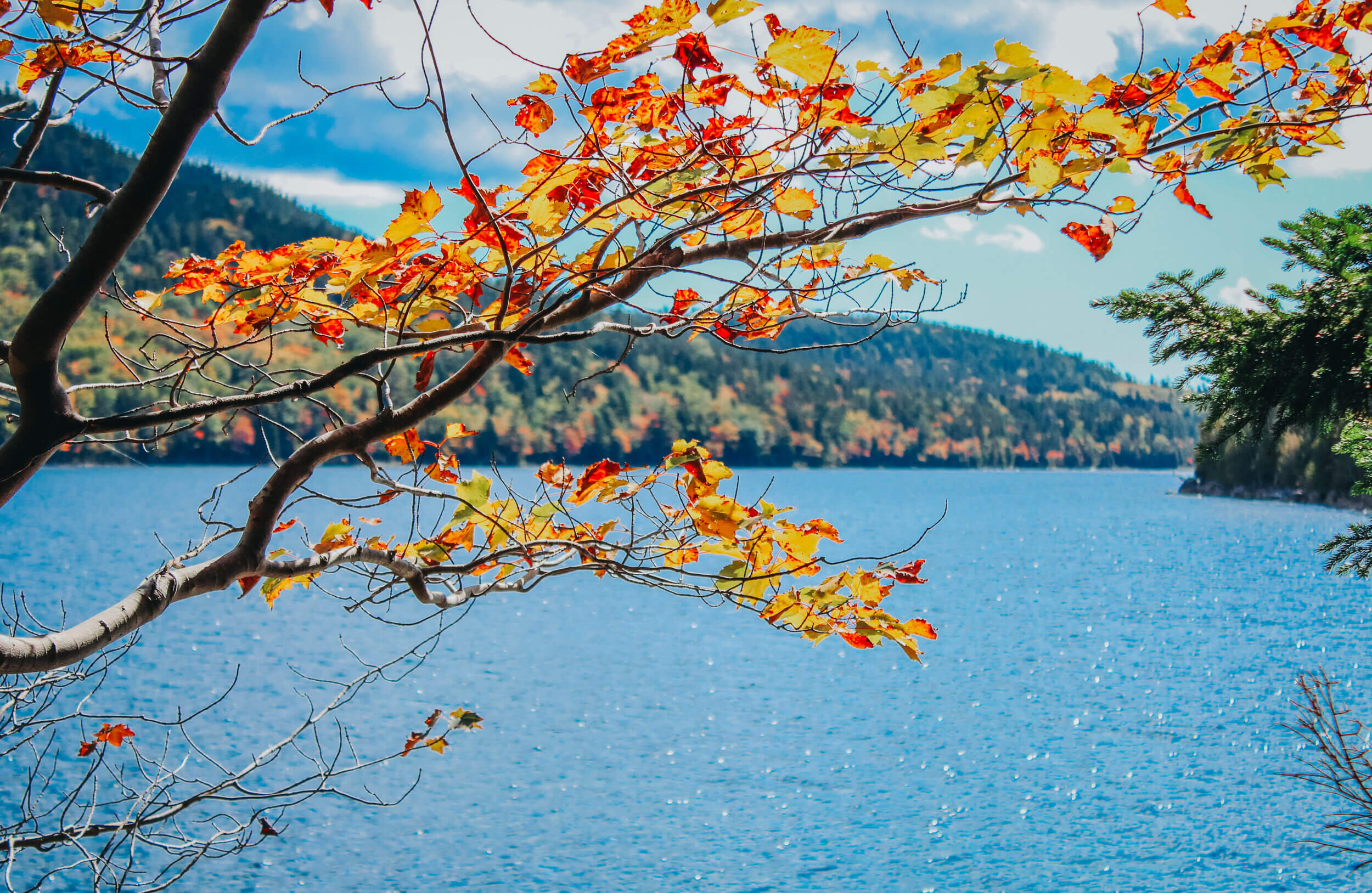
I found so many beautiful maple leaves on the trail. Some were bigger than my face!
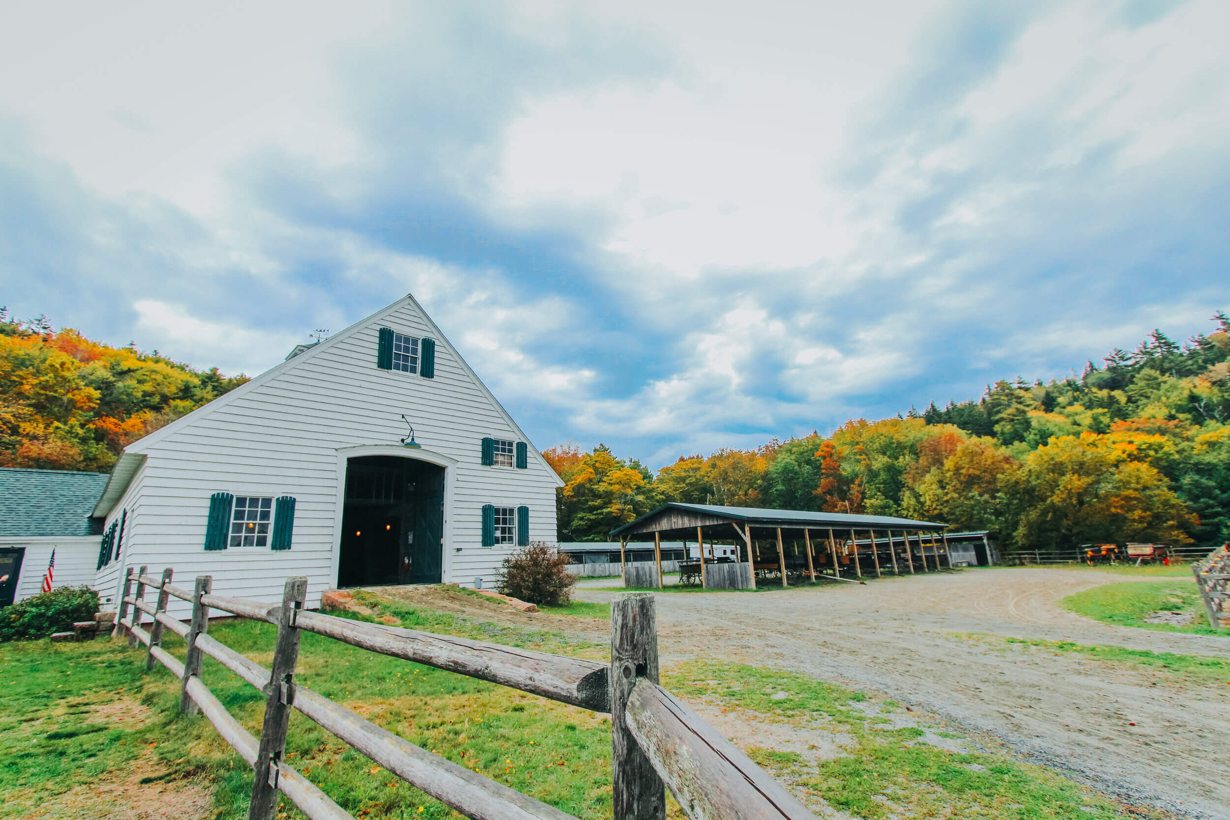
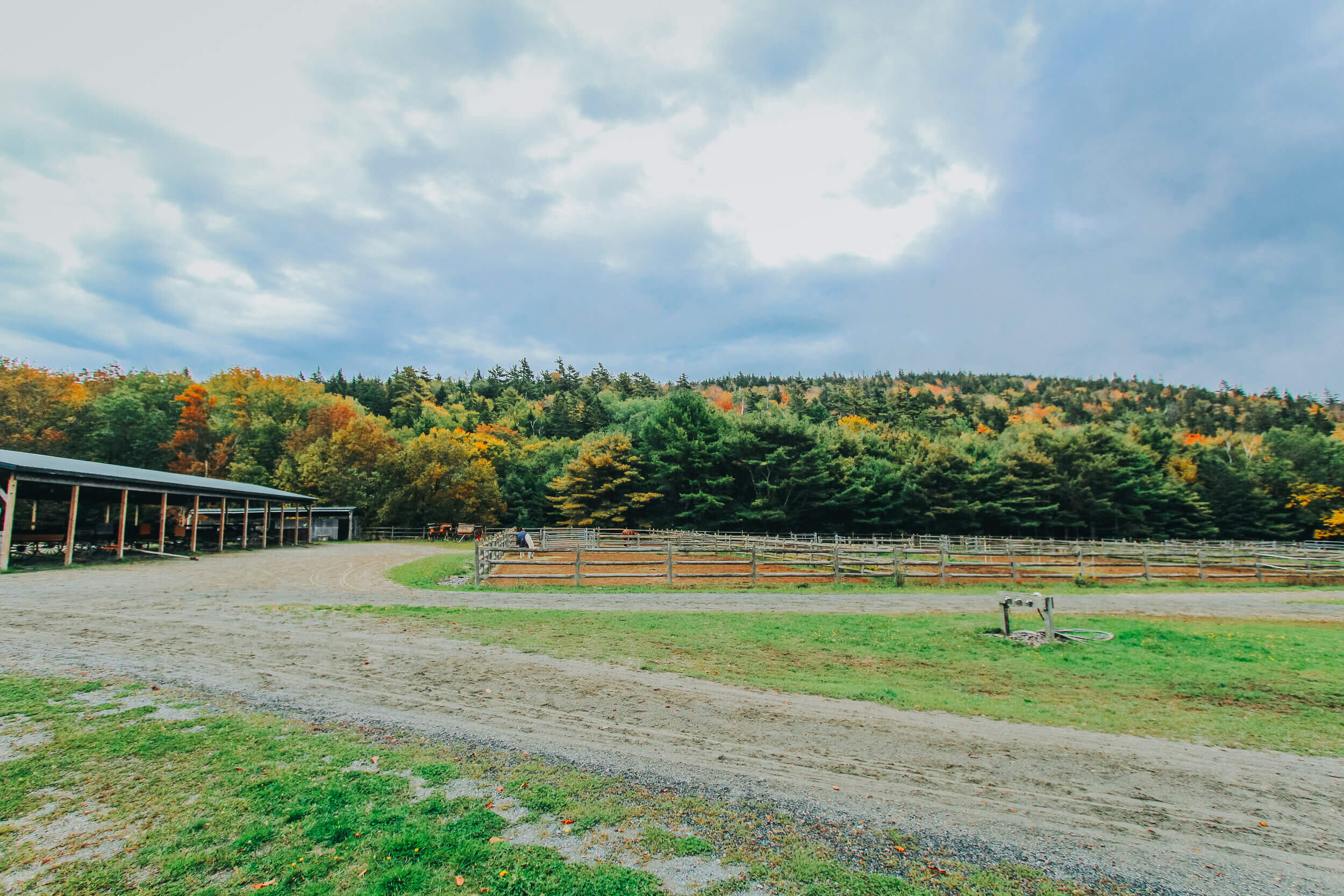
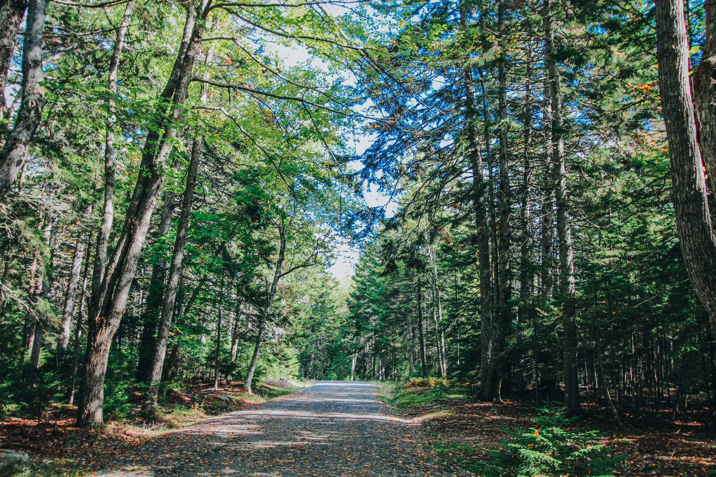
CARRIAGE ROADS
Located just off of Park Loop Road, close to Jordan Pond, are the Carriages of Acadia. Here you can book a horse-drawn carriage tour along the Park’s carriage roads. The Carriage Roads were built in the early 1900’s by renowned philanthropist, John D. Rockefeller, Jr for the use of hikers, bikers, horse riders, and horse-drawn carriages on the island. These roads are all free of motor vehicles. There are 45 miles of carriage roads within Acadia National Park, and some allow for cross-country skiing and snowmobiling. There are a few locations in the park, like Jordan Pond or Eagle Lake, where you can park your vehicle and walk along the carriage roads.

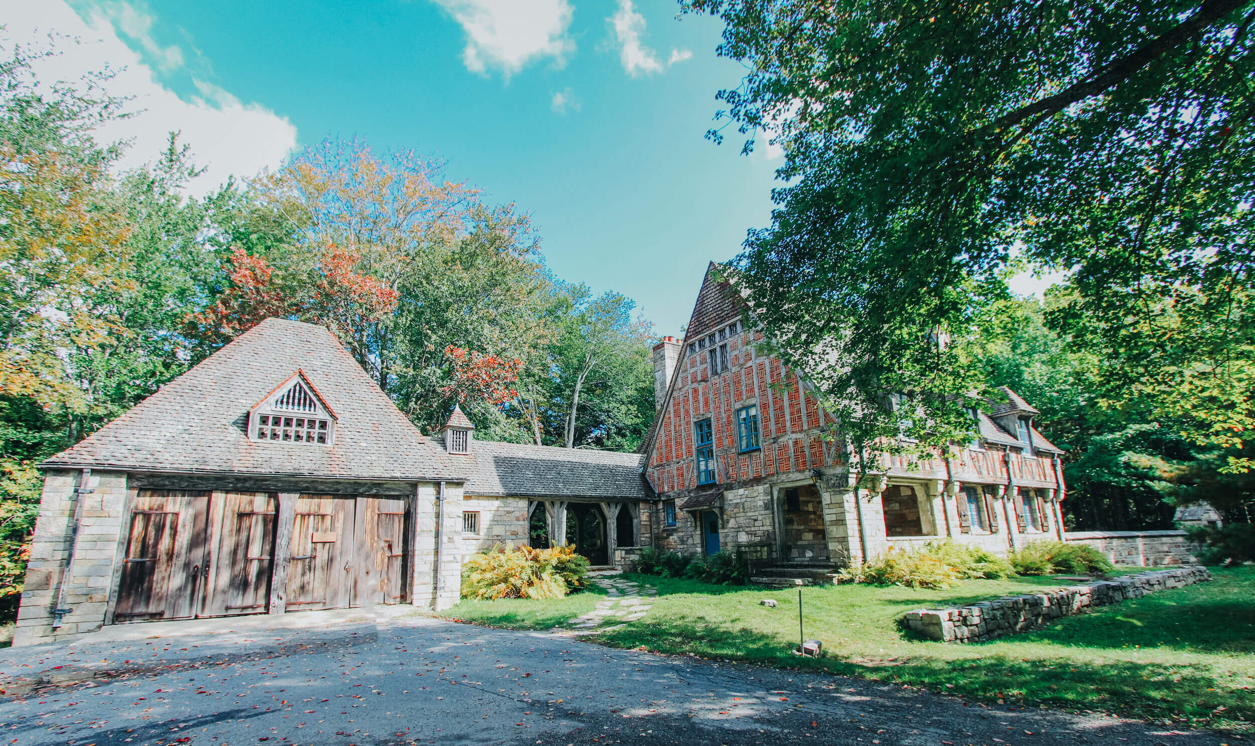
The Jordan Pond Gate Lodge was financed by John D. Rockefeller Jr. and designed by Grosvenor Atterbury in the French Romanesque style because of the area’s early connections to France. Completed in 1932, the intention behind its construction was to mark the entrance of the carriage roads and prevent automobiles from entering.
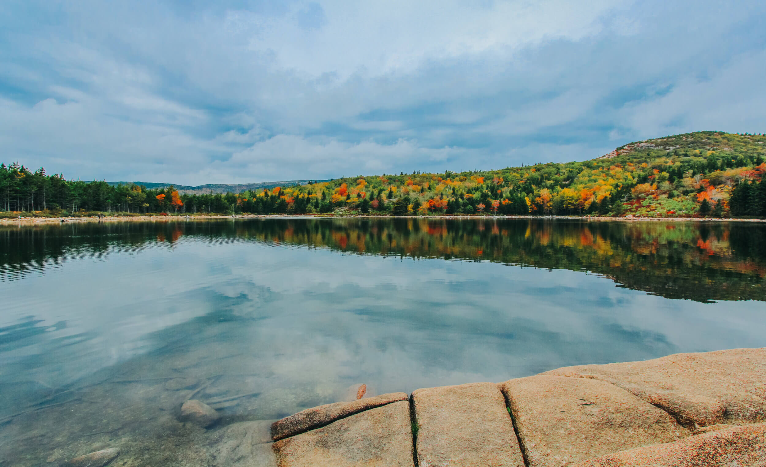
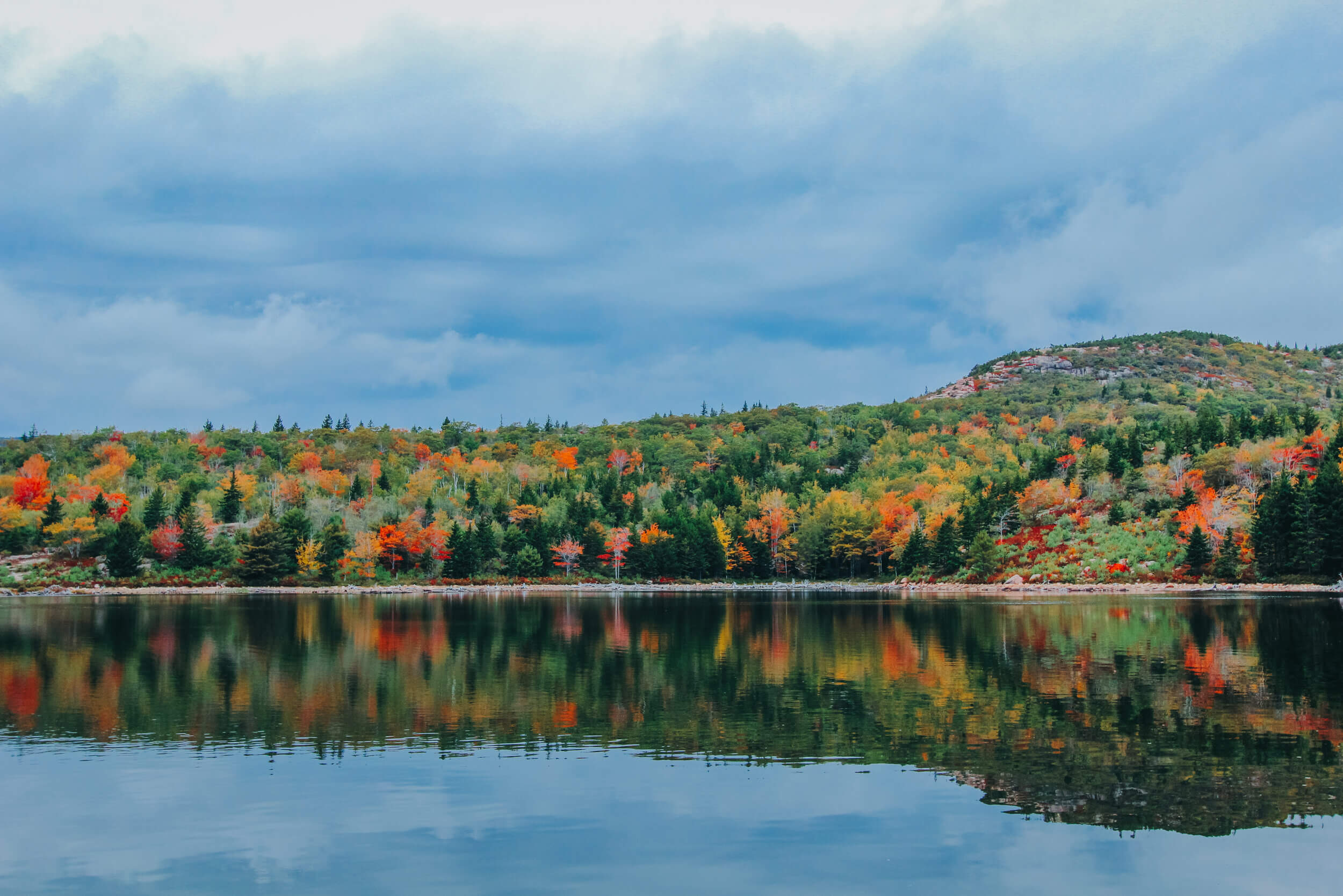
JORDAN POND
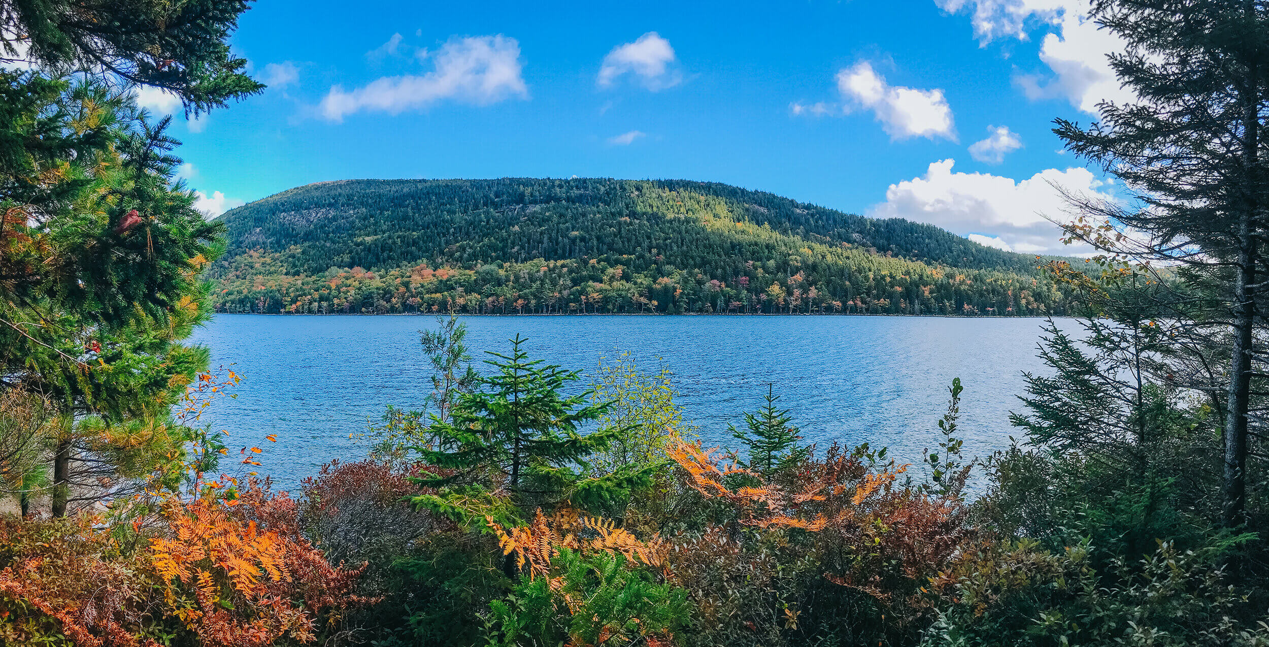
A famous combination within Acadia National Park is the Jordan Pond and Jordan Pond House Restaurant. in the late 1800s, the restaurant first established the tradition of having tea and popovers on the lawn while overlooking the Jordan Pond and North and South Bubble Mountains. The restaurant is open seasonally from 11:30 am to 8:00 pm from May to October.
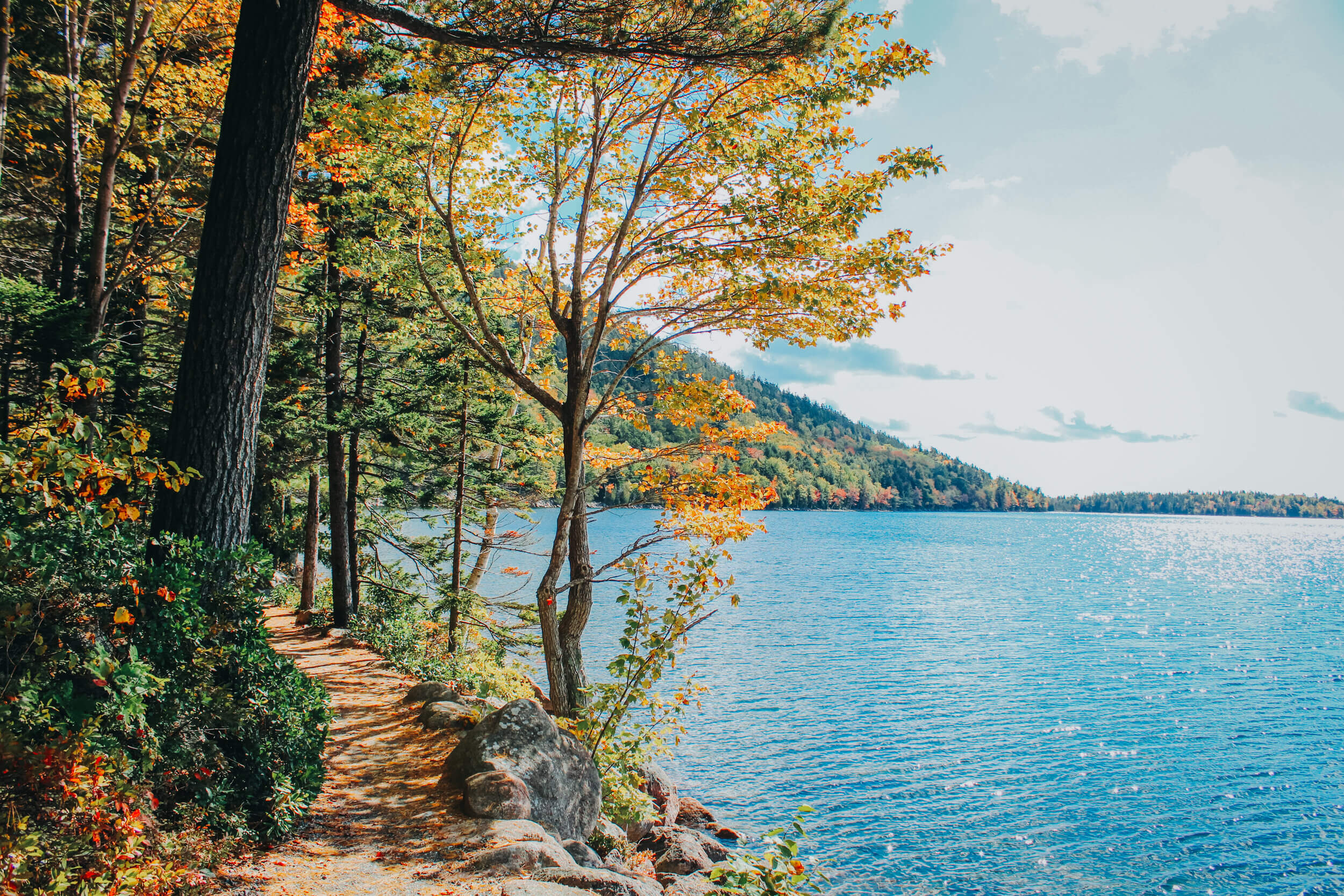
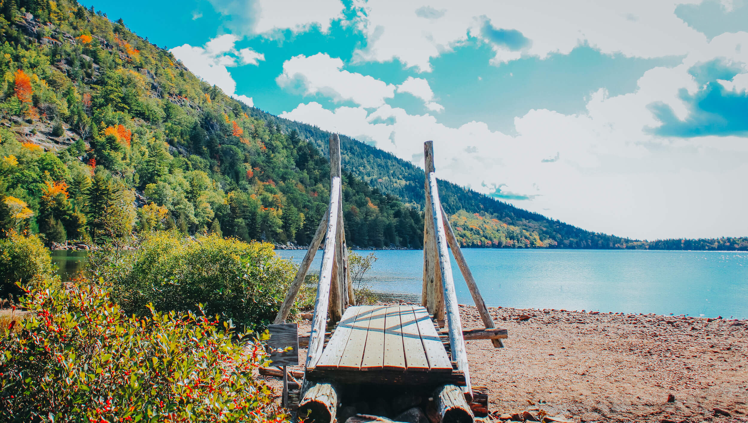
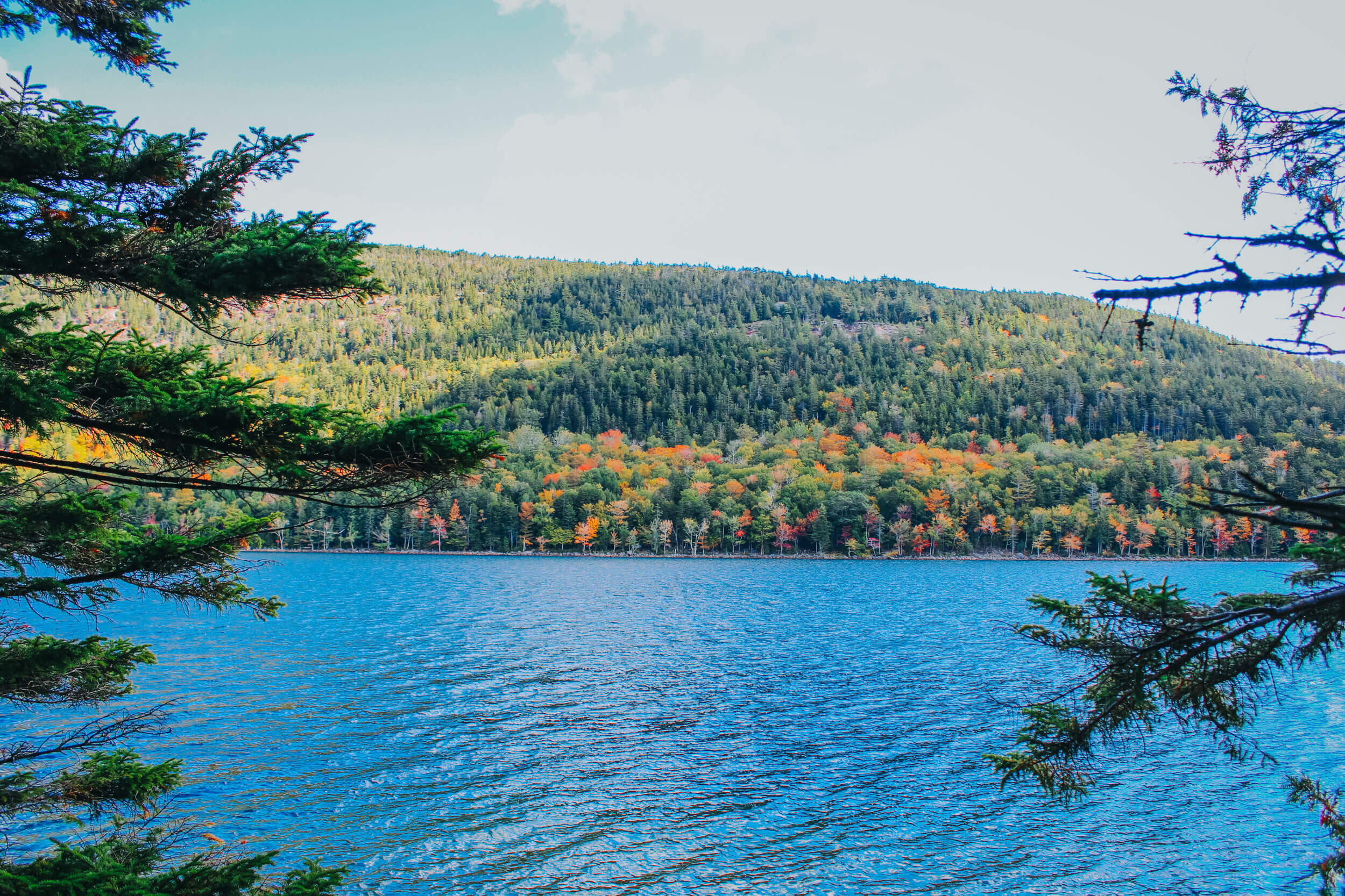
The Jordan Pond Shore trail is a must while at this area of the park! The 3.4-mile loop trail is a fairly simple, yet moderate hike around the pond. The majority of the trail is on a normal dirt trail or boardwalk (built to protect the plant life by the pond). There are some areas where you will have to scramble across some rocks and boulders, so proceed with caution if the weather is unfavorable. Keep in mind, there is no swimming in the pond since this is the water supply for Seal Harbor.

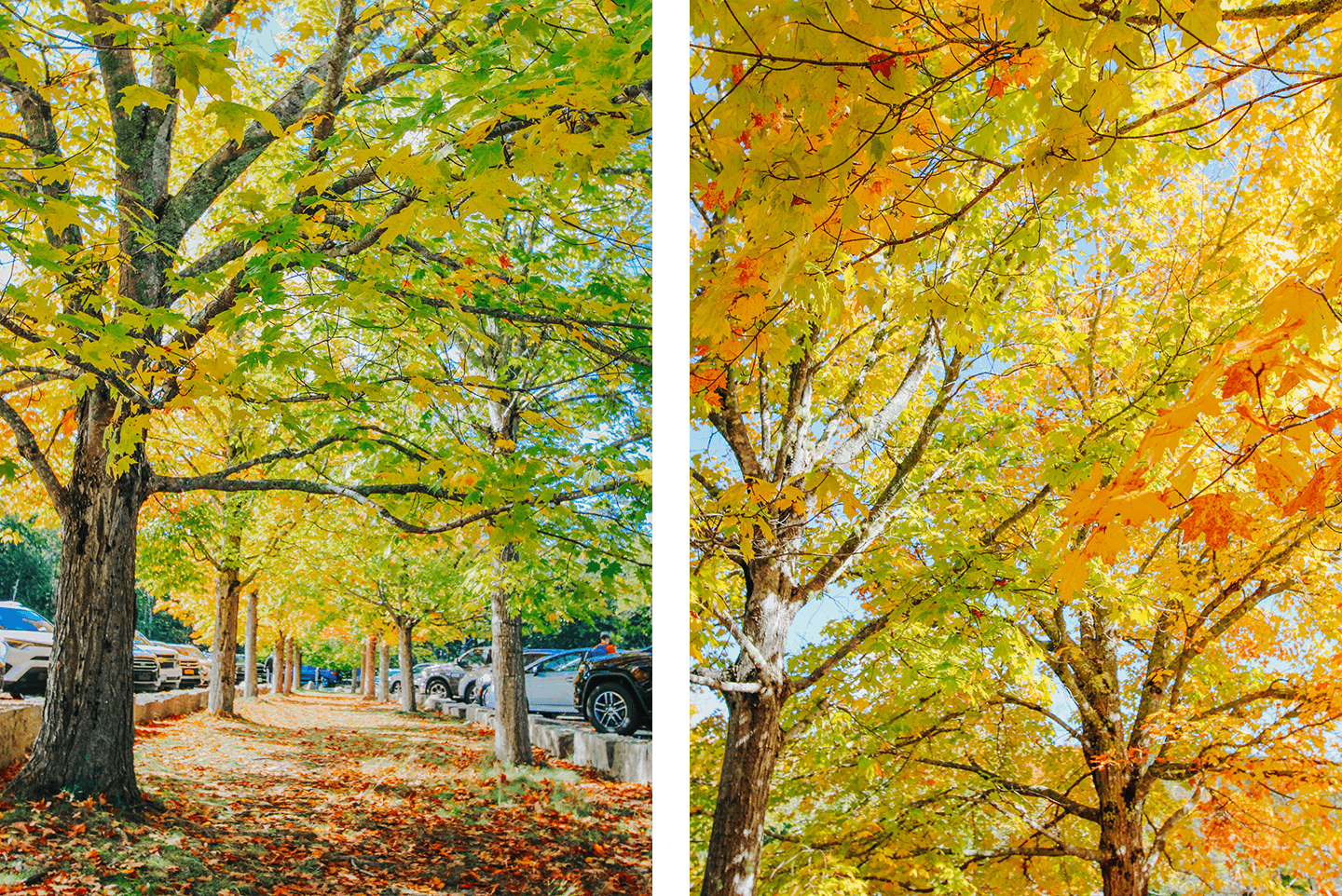
Parking is very limited in Jordan Pond and by the Jordan Pond House Restaurant. There are two lots for parking, both of which were packed when we first arrived! We drove around the lots for at least 30 minutes. I could tell my dad was beginning to get frustrated and wanted to leave. I asked him before we left if I could at least step outside of the car and take some pictures of the beautiful foliage in the parking lot. He pulled over to let me do so. I walked along the median with the row of some of the most spectacularly colored trees I have ever seen, taking pictures as I went. As he drove around the parking lot to pick me up, a car in the exact spot I was standing in front of was leaving for the day, and we got a spot! Sometimes, you just have to enjoy the moment and the scenery around you, and what is meant to find you will find you- like the parking spot at Jordan Pond!


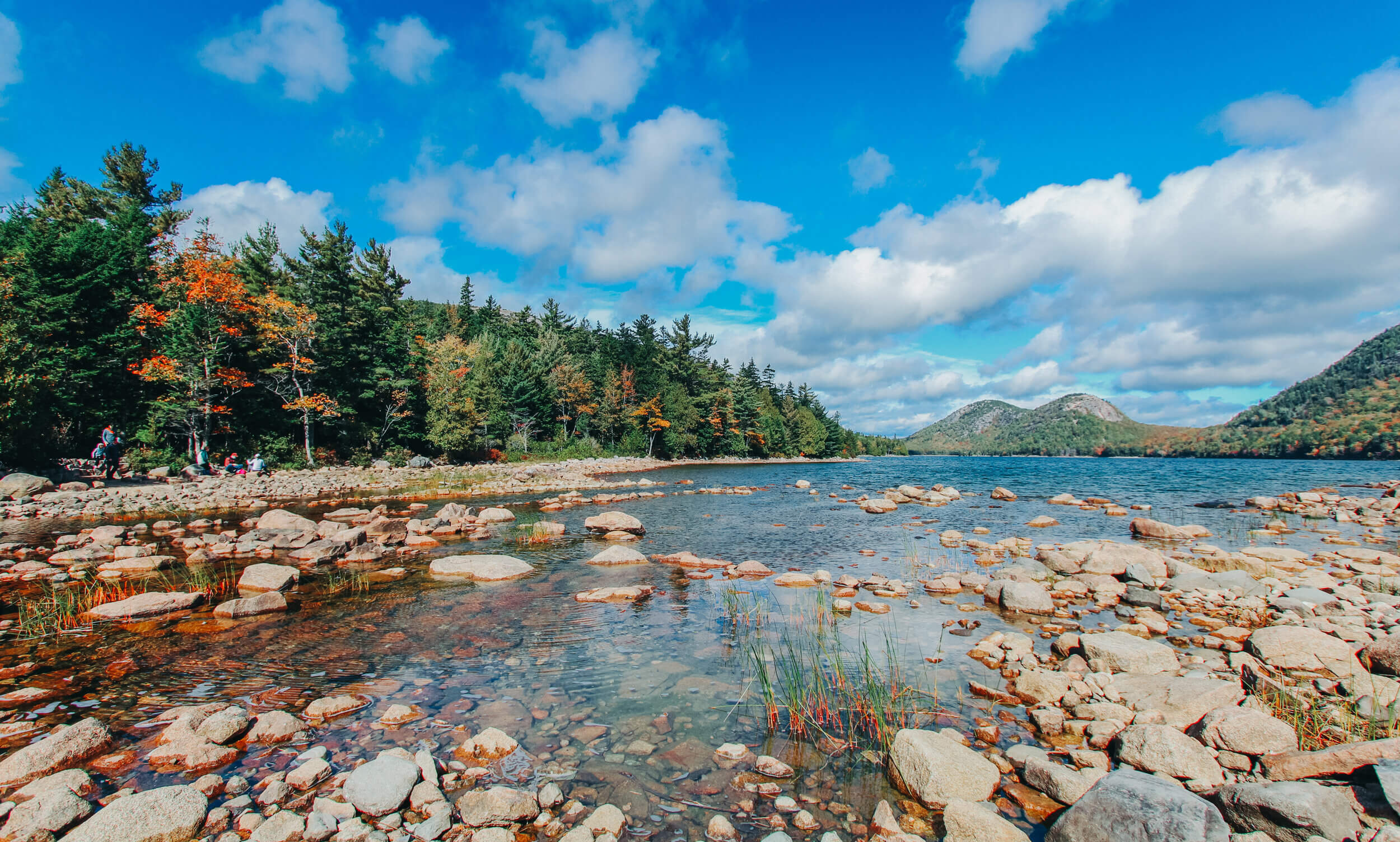
The view of Jordan Pond from the beginning of the loop’s trailhead. I suggest checking the weather forecast before visiting the Jordan Pond. We had a few days that were a bit cloudy and overcast. On the first sunny day, we visited both Cadillac Mountain and Jordan Pond to optimum views of both places. The sights did not disappoint!


Have you ever been to Acadia National Park? If so, where are some of your favorite sights to see, places to hike, etc? Comment below!


Leave a Reply